MyTopo
Fenton Iowa US Topo Map
Couldn't load pickup availability
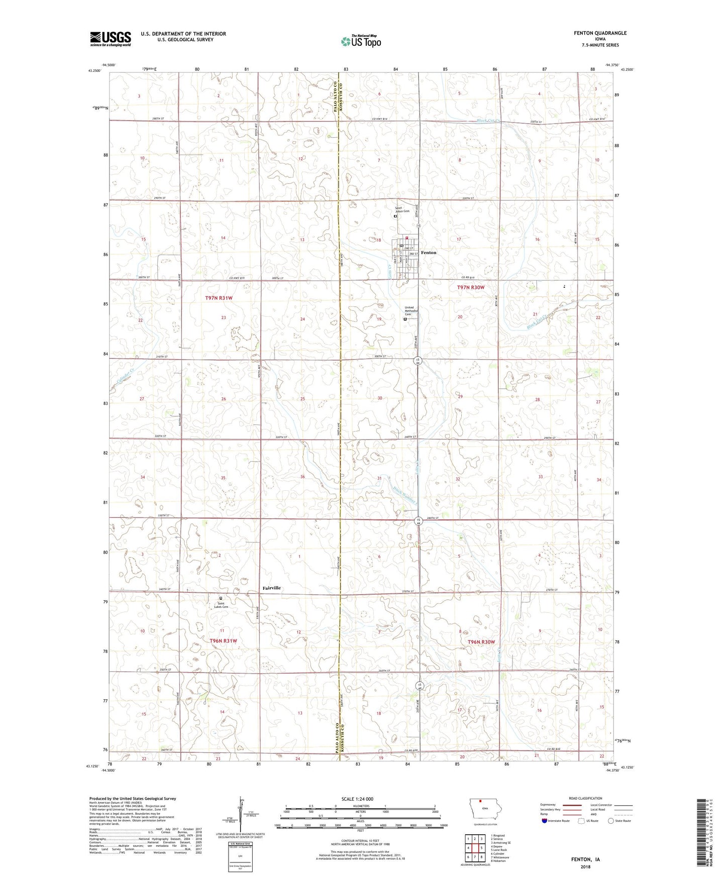
2022 topographic map quadrangle Fenton in the state of Iowa. Scale: 1:24000. Based on the newly updated USGS 7.5' US Topo map series, this map is in the following counties: Kossuth, Palo Alto. The map contains contour data, water features, and other items you are used to seeing on USGS maps, but also has updated roads and other features. This is the next generation of topographic maps. Printed on high-quality waterproof paper with UV fade-resistant inks.
Quads adjacent to this one:
West: Depew
Northwest: Ringsted
North: Seneca
Northeast: Armstrong SE
East: Lone Rock
Southeast: Hobarton
South: Whittemore
Southwest: Cylinder
This map covers the same area as the classic USGS quad with code o43094b4.
Contains the following named places: City of Fenton, Ditch Number 1, Fairville, Fairville Post Office, Fenton, Fenton City Hall, Fenton Post Office, Fenton Public Library, Fenton Volunteer Fire Department, North Sentral Kossuth Middle School, North Union Elementary School Fenton Campus, Saint Johns Cemetery, Saint John's Lutheran Church, Saint Lukes Cemetery, Saint Lukes Church, Sentral Area Ambulance, State Line Co-op Elevator, Township of Fenton, Township of Lotts Creek, United Methodist Cemetery, United Methodist Church, ZIP Code: 50539