MyTopo
Seneca Iowa US Topo Map
Couldn't load pickup availability
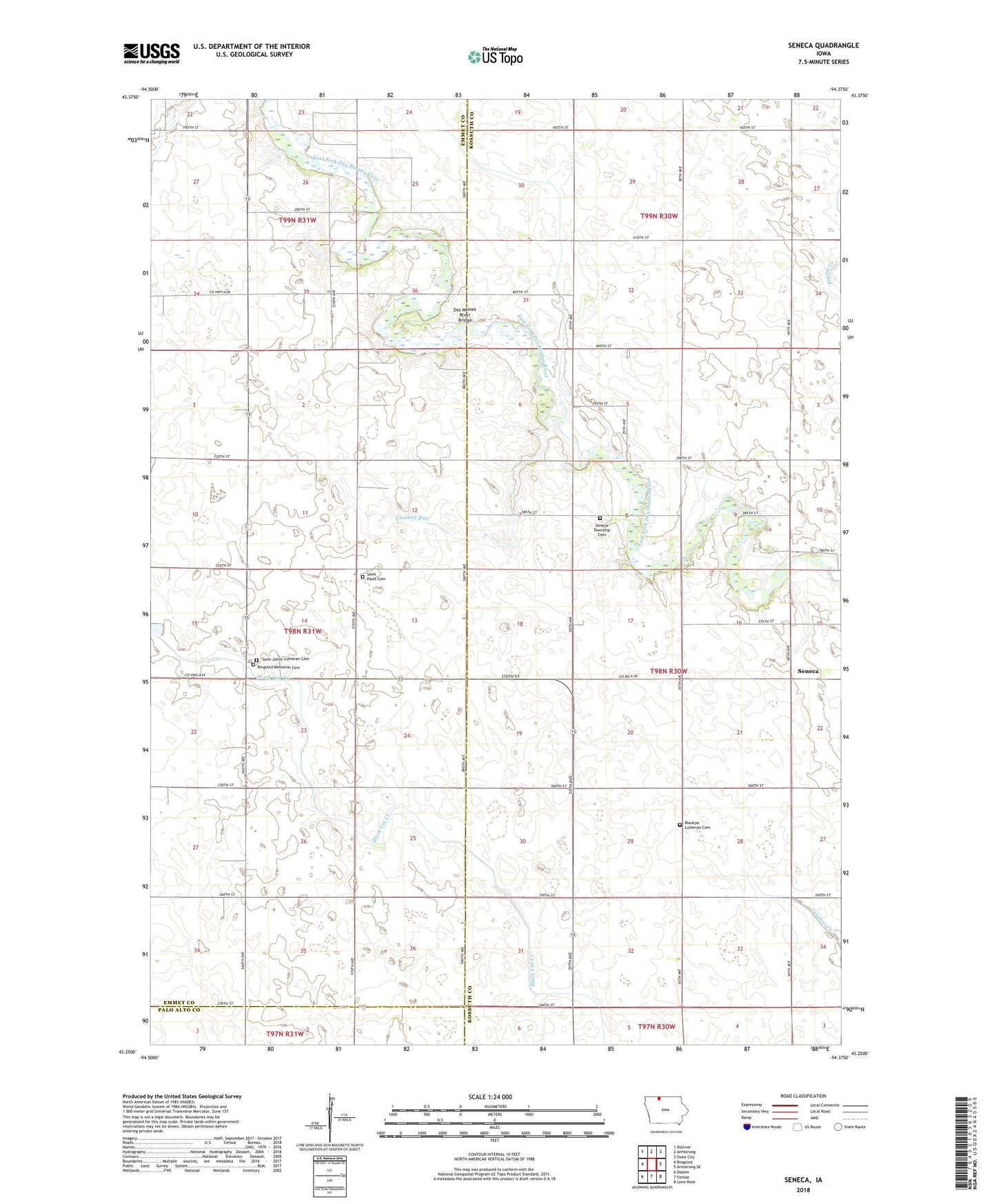
2022 topographic map quadrangle Seneca in the state of Iowa. Scale: 1:24000. Based on the newly updated USGS 7.5' US Topo map series, this map is in the following counties: Kossuth, Emmet, Palo Alto. The map contains contour data, water features, and other items you are used to seeing on USGS maps, but also has updated roads and other features. This is the next generation of topographic maps. Printed on high-quality waterproof paper with UV fade-resistant inks.
Quads adjacent to this one:
West: Ringsted
Northwest: Dolliver
North: Armstrong
Northeast: Swea City
East: Armstrong SE
Southeast: Lone Rock
South: Fenton
Southwest: Depew
This map covers the same area as the classic USGS quad with code o43094c4.
Contains the following named places: Armstrong Grove Post Office, Bacon Maker Farm, Blackjar Lutheran Cemetery, Blackjer Church, Crooked Run, Des Moines River Bridge, East Des Moines Access Public Hunting Area, Forsyth, Forsyth Post Office, Memorial Cemetery, Saint John Church, Saint John Lutheran Cemetery, Saint Pauls Lutheran Cemetery, Seneca, Seneca Access, Seneca Access Public Hunting Area, Seneca Post Office, Seneca Township Cemetery, Township of Seneca