MyTopo
Arispe Iowa US Topo Map
Couldn't load pickup availability
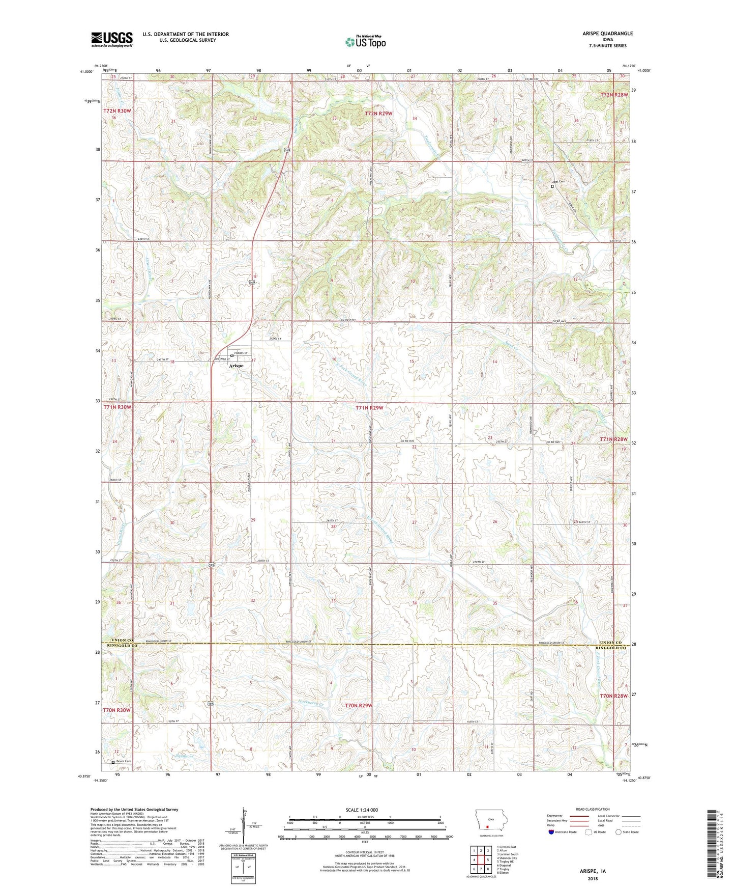
2023 topographic map quadrangle Arispe in the state of Iowa. Scale: 1:24000. Based on the newly updated USGS 7.5' US Topo map series, this map is in the following counties: Union, Ringgold. The map contains contour data, water features, and other items you are used to seeing on USGS maps, but also has updated roads and other features. This is the next generation of topographic maps. Printed on high-quality waterproof paper with UV fade-resistant inks.
Quads adjacent to this one:
West: Shannon City
Northwest: Creston East
North: Afton
Northeast: Lorimor South
East: Tingley NE
Southeast: Ellston
South: Tingley
Southwest: Diagonal
This map covers the same area as the classic USGS quad with code o40094h2.
Contains the following named places: Abel Cemetery, Arispe, Arispe Post Office, Bever Cemetery, City of Arispe, East Union Elementary School, Eugene, Indian Creek, Methodist Church, Olivet Post Office, Shepard, Shepard Post Office, Township of Sand Creek