MyTopo
Farmington Iowa US Topo Map
Couldn't load pickup availability
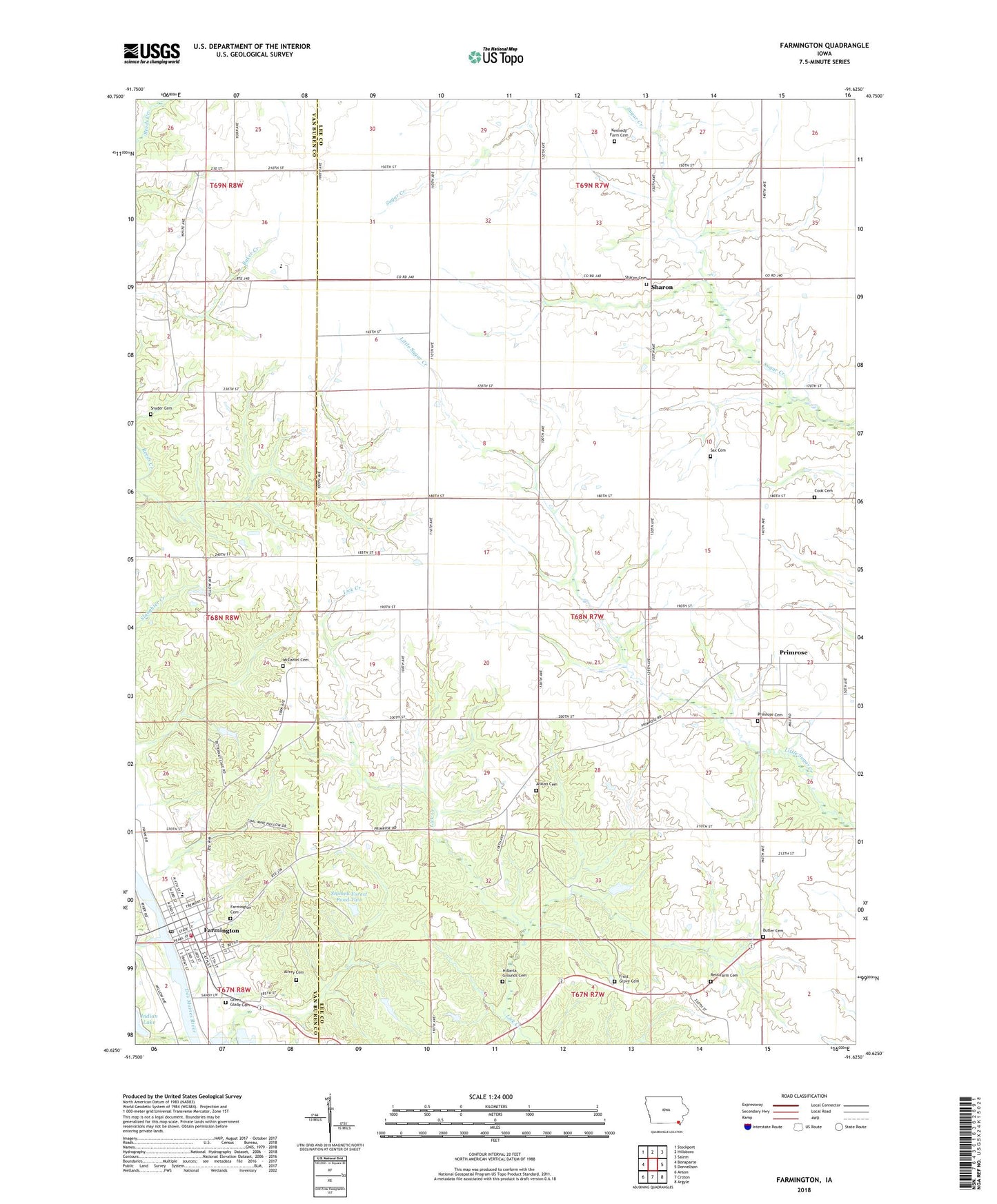
2022 topographic map quadrangle Farmington in the state of Iowa. Scale: 1:24000. Based on the newly updated USGS 7.5' US Topo map series, this map is in the following counties: Lee, Van Buren. The map contains contour data, water features, and other items you are used to seeing on USGS maps, but also has updated roads and other features. This is the next generation of topographic maps. Printed on high-quality waterproof paper with UV fade-resistant inks.
Quads adjacent to this one:
West: Bonaparte
Northwest: Stockport
North: Hillsboro
Northeast: Salem
East: Donnellson
Southeast: Argyle
South: Croton
Southwest: Anson
This map covers the same area as the classic USGS quad with code o40091f6.
Contains the following named places: Acklam Cemetery, Alfrey Cemetery, Assembly of God Church, Big Indian Creek, Butler Cemetery, Christy Clinic, Church of the Nazarene, City of Farmington, Cook Cemetery, Farmington, Farmington Cemetery, Farmington City Hall, Farmington Clinic, Farmington Fire Department and Emergency Medical Services, Farmington Post Office, Farmington Public Library, First Baptist Church, Frost Grove Cemetery, George Perkins Historical Marker, Green Glade Cemetery, H Banla Grounds Cemetery, Harmony Elementary School, Harmony Middle School, Indian Lake Park Trail, Kennedy Farm Cemetery, Keteban Switch, McDaniel Cemetery, Pioneer Historical Museum, Plymouth, Primrose, Primrose Cemetery, Primrose Post Office, Reid Farm Cemetery, Riverview Campground, Sax Cemetery, Sharon, Sharon Cemetery, Sharon United Presbyterian Church, Shimek Forest Dam Three, Shimek Forest Pond Two, Shimek Forest Trail, Shimek State Forest Wildlife Management Area - Donnellson Unit, Shimek State Forest Wildlife Management Area - Farmington Unit, Snyder Cemetery, Township of Harrison, United Methodist Church