MyTopo
Earlham East Iowa US Topo Map
Couldn't load pickup availability
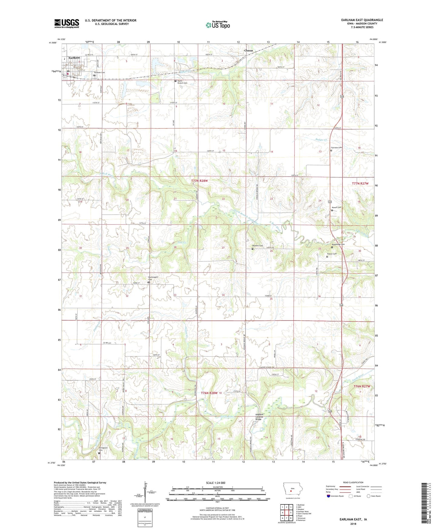
2022 topographic map quadrangle Earlham East in the state of Iowa. Scale: 1:24000. Based on the newly updated USGS 7.5' US Topo map series, this map is in the following counties: Madison. The map contains contour data, water features, and other items you are used to seeing on USGS maps, but also has updated roads and other features. This is the next generation of topographic maps. Printed on high-quality waterproof paper with UV fade-resistant inks.
Quads adjacent to this one:
West: Earlham West
Northwest: Redfield
North: Adel
Northeast: Waukee
East: Saint Charles NW
Southeast: Patterson
South: Winterset
Southwest: Pitzer
This map covers the same area as the classic USGS quad with code o41094d1.
Contains the following named places: Bennett Cemetery, Church of Christ, City of Earlham, Clucas, Crossroad Evangelical Free Church, Earlham, Earlham Cemetery, Earlham City Hall, Earlham Elementary School, Earlham Fire and Rescue, Earlham Friends Church, Earlham High School, Earlham Library, Earlham Medical Clinic, Earlham Middle School, Earlham Police Department, Earlham Post Office, Earlham Quarry, Fairview Cemetery, Fairview Church, Farmers Co-op Elevator, First Presbyterian Church, Goeldner Woods County Park, Hogback Covered Bridge, Howerdon Creek, Jefferson School, Monarch Quarry, North Branch Cemetery, North Branch Post Office, North Post Office, North River School, Orman Creek, Powell Cemetery, Rodabough Cemetery, Stringtown Cemetery, Tom Creek, Township of Douglas, Township of Madison, Trester Cemetery, United Methodist Church, Washington School, Worthington Cemetery, Worthington Church, ZIP Code: 50072