MyTopo
Westboro Missouri US Topo Map
Couldn't load pickup availability
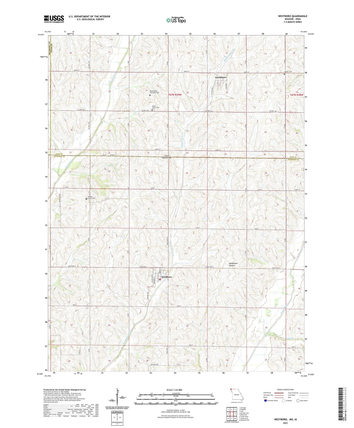
2021 topographic map quadrangle Westboro in the states of Missouri, Iowa. Scale: 1:24000. Based on the newly updated USGS 7.5' US Topo map series, this map is in the following counties: Atchison, Page, Fremont. The map contains contour data, water features, and other items you are used to seeing on USGS maps, but also has updated roads and other features. This is the next generation of topographic maps. Printed on high-quality waterproof paper with UV fade-resistant inks.
Quads adjacent to this one:
West: Farmers City
Northwest: Farragut
North: Bingham
Northeast: Coin
East: Blanchard
Southeast: Skidmore NW
South: Tarkio East
Southwest: Tarkio West
This map covers the same area as the classic USGS quad with code o40095e3.
Contains the following named places: City of Northboro, City of Westboro, Emporia School, Henn Landing Strip, Houser Cemetery, Long Branch, Morning Sun School, Northboro, Northboro Post Office, Northboro Town Hall, Township of Lincoln, Township of Washington, Union Grove Cemetery, Union Grove Post Office, United Methodist Church, Walden Grove Cemetery, Walkerville, Washington Township Cemetery, Westboro, Westboro Post Office, Westboro Rural Volunteer Fire Department, Willsburg, ZIP Codes: 51647, 64498