MyTopo
Postville NW Iowa US Topo Map
Couldn't load pickup availability
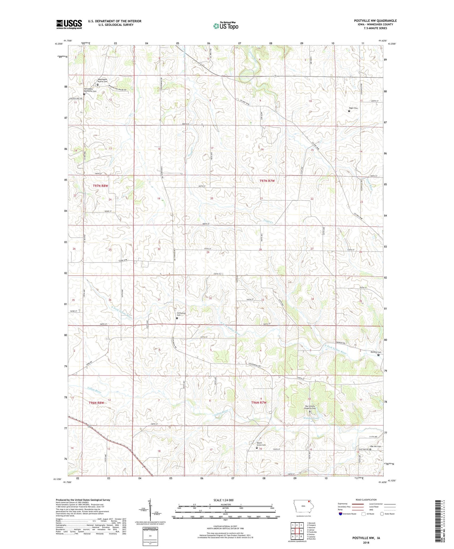
2022 topographic map quadrangle Postville NW in the state of Iowa. Scale: 1:24000. Based on the newly updated USGS 7.5' US Topo map series, this map is in the following counties: Winneshiek. The map contains contour data, water features, and other items you are used to seeing on USGS maps, but also has updated roads and other features. This is the next generation of topographic maps. Printed on high-quality waterproof paper with UV fade-resistant inks.
Quads adjacent to this one:
West: Calmar
Northwest: Decorah
North: Freeport
Northeast: Hanover
East: Frankville
Southeast: Postville
South: Castalia
Southwest: Festina
This map covers the same area as the classic USGS quad with code o43091b6.
Contains the following named places: Centennial Cemetery, Hyde Post Office, Moneek Cemetery, Mount Grove Cemetery, Norwegian Methodist Cemetery, Norwegian Methodist Church, Oak Hill Cemetery, Pagin Cemetery, Roy Schultz Property Cemetery, Township of Bloomfield, Township of Frankville, Trout River Post Office, Walden Pond, Washington Prairie Cemetery, Washington Prairie Church, Woodside Post Office