MyTopo
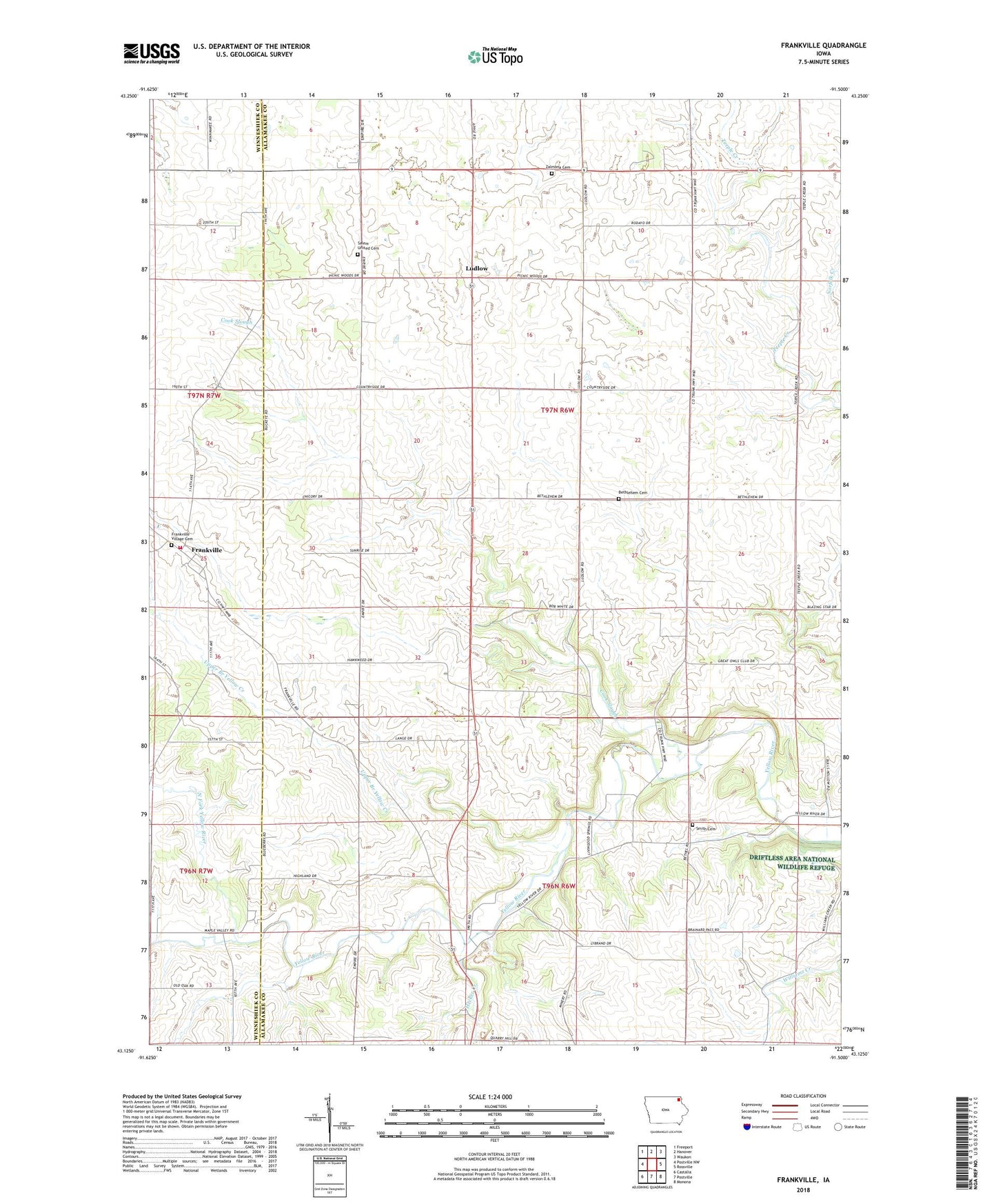
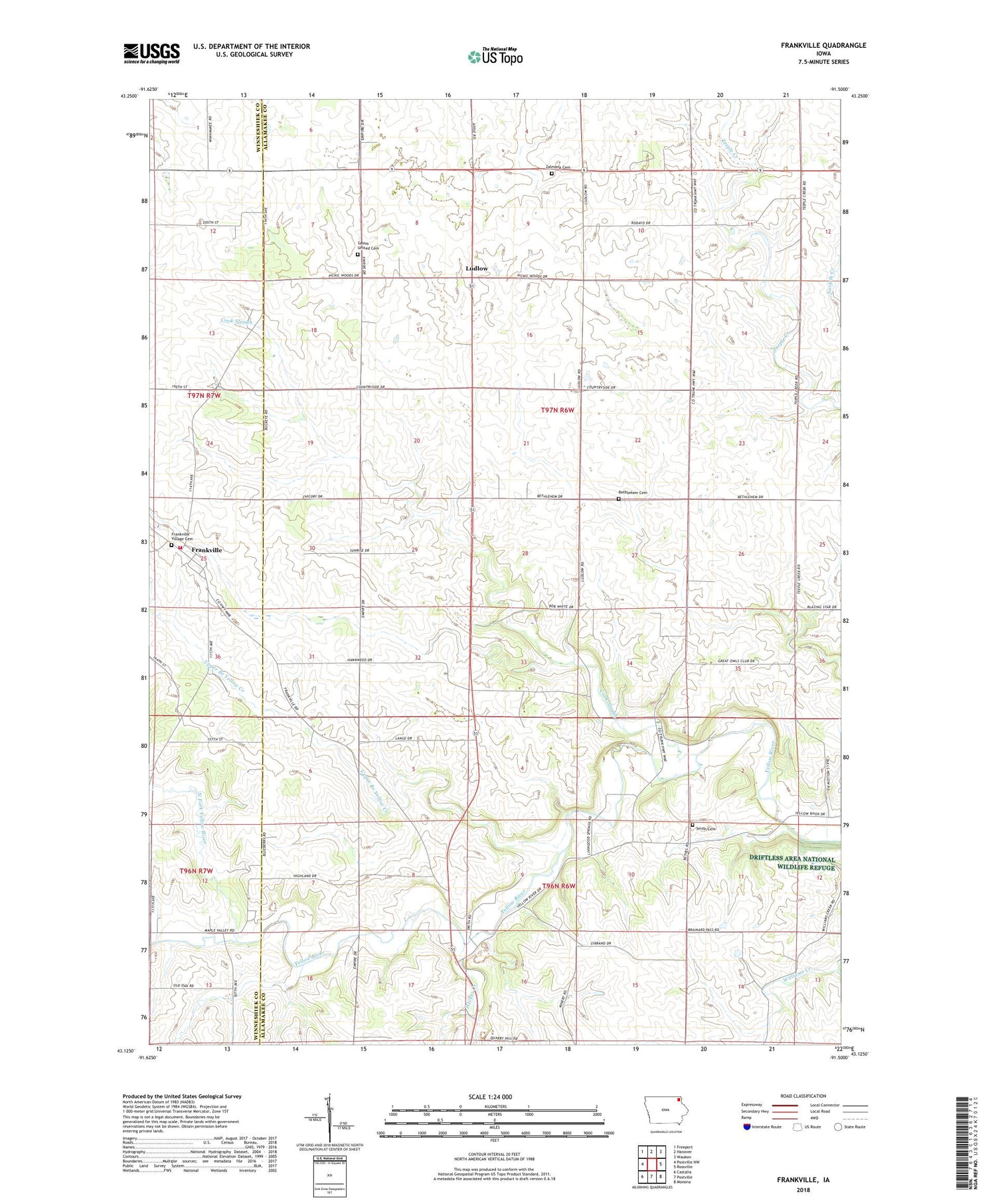
Frankville Iowa US Topo Map
Couldn't load pickup availability
2022 topographic map quadrangle Frankville in the state of Iowa. Scale: 1:24000. Based on the newly updated USGS 7.5' US Topo map series, this map is in the following counties: Allamakee, Winneshiek. The map contains contour data, water features, and other items you are used to seeing on USGS maps, but also has updated roads and other features. This is the next generation of topographic maps. Printed on high-quality waterproof paper with UV fade-resistant inks.
Quads adjacent to this one:
West: Postville NW
Northwest: Freeport
North: Hanover
Northeast: Waukon
East: Rossville
Southeast: Monona
South: Postville
Southwest: Castalia
This map covers the same area as the classic USGS quad with code o43091b5.
Contains the following named places: Bethlehem Cemetery, Bethlehem Church, Cleyeland, Frankville, Frankville Community United Presbyterian Church, Frankville Fire Department, Frankville Park, Frankville Post Office, Frankville School, Frankville Village Cemetery, Hecker Creek, Jamestown Post Office, Kingdom Hall, Ludlow, Ludlow Creek, Ludlow Post Office, Marilie Educational Forest Reserve Wildlife Area, Moneek, Moneek Post Office, Myron Post Office, North Fork Yellow River, Salem Church, Salem United Cemetery, Smith Cemetery, Stella Post Office, Township of Ludlow, Upper Branch Yellow Creek, Zalmona Cemetery, Zalmona Church