MyTopo
Frytown Iowa US Topo Map
Couldn't load pickup availability
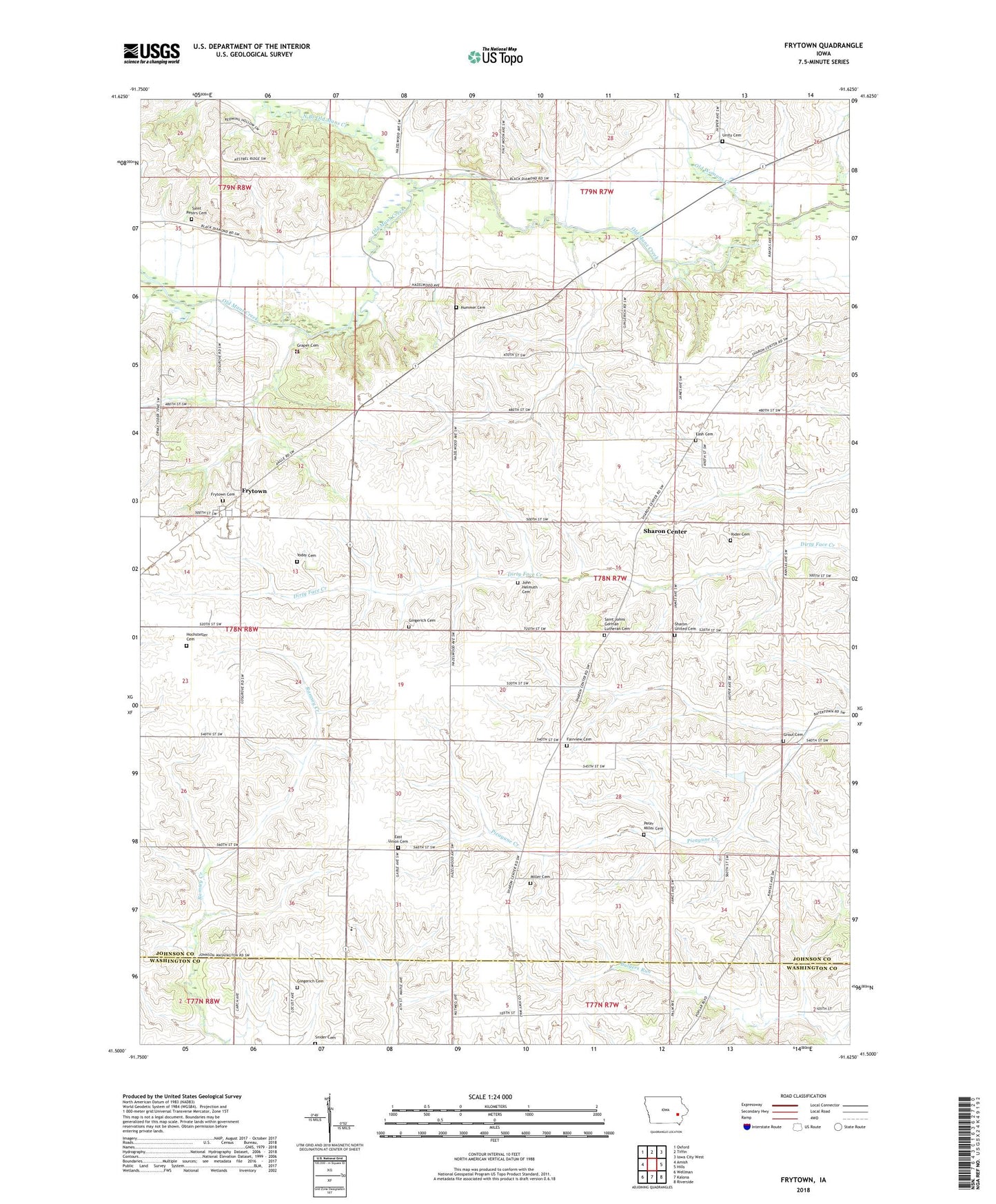
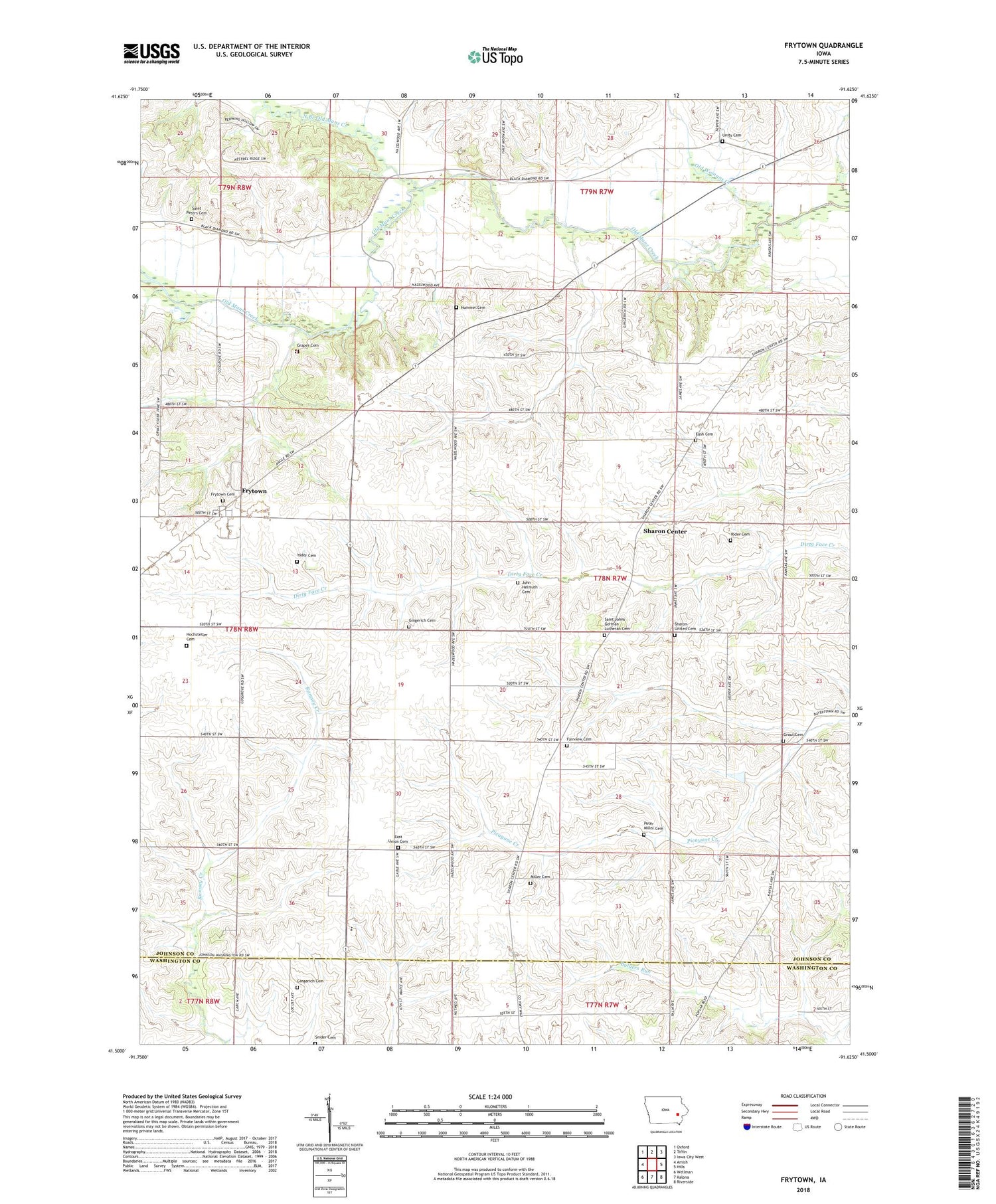
2022 topographic map quadrangle Frytown in the state of Iowa. Scale: 1:24000. Based on the newly updated USGS 7.5' US Topo map series, this map is in the following counties: Johnson, Washington. The map contains contour data, water features, and other items you are used to seeing on USGS maps, but also has updated roads and other features. This is the next generation of topographic maps. Printed on high-quality waterproof paper with UV fade-resistant inks.
Quads adjacent to this one:
West: Amish
Northwest: Oxford
North: Tiffin
Northeast: Iowa City West
East: Hills
Southeast: Riverside
South: Kalona
Southwest: Wellman
Contains the following named places: Belle Air, Belle Air Post Office, Boone School, Eash Cemetery, East Lincoln School, East Union Cemetery, East Union Church, Evergreen School, Fairview Church, Fairview Mennonite Cemetery, Frank Pierce Post Office, Frytown, Frytown Cemetery, Frytown Census Designated Place, Gingerich Cemetery, Graper Cemetery, Hartsock School, Haven Church, Hochstetler Cemetery, Hummer Cemetery, John Helmuth Cemetery, North Branch Old Mans Creek, Old Womans Creek, Pathway Christian School, Peter Miller Cemetery, Redbird Farms Wildlife Area, Saint Johns Church, Saint Johns German Lutheran Cemetery, Saint Peters Cemetery, Sharon Bethel Church, Sharon Cemetery, Sharon Center, Sharon Center Cemetery, Sharon Center Post Office, Sharon Church, Snider Cemetery, South Gingerich Mennonite Cemetery, Township of Sharon, Unity Cemetery, Willow Grove School, Yoder Cemetery, ZIP Code: 52247