MyTopo
Weldon Iowa US Topo Map
Couldn't load pickup availability
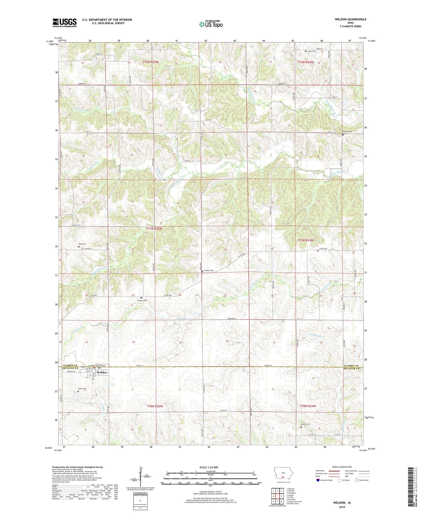
2022 topographic map quadrangle Weldon in the state of Iowa. Scale: 1:24000. Based on the newly updated USGS 7.5' US Topo map series, this map is in the following counties: Clarke, Decatur. The map contains contour data, water features, and other items you are used to seeing on USGS maps, but also has updated roads and other features. This is the next generation of topographic maps. Printed on high-quality waterproof paper with UV fade-resistant inks.
Quads adjacent to this one:
West: Lacelle
Northwest: Osceola
North: Jamison
Northeast: Woodburn
East: Le Roy
Southeast: Garden Grove
South: Garden Grove SW
Southwest: Van Wert
This map covers the same area as the classic USGS quad with code o40093h6.
Contains the following named places: Bartlettville Post Office, Chaney Cemetery, City of Weldon, Ellis Cemetery, Hebron Cemetery, Hoosier Creek, Horton Cemetery, Jack Creek Post Office, Kline Cemetery, Lewis Cemetery, Metier Cemetery, North Hoosier Creek, Salem Mennonite Church, Shelby Post Office, Township of Green Bay, Turkey Ridge Wildlife Area, Weldon, Weldon Emergency Medical Services, Weldon Fire Department, Weldon Post Office, ZIP Code: 50264