MyTopo
Thornton Iowa US Topo Map
Couldn't load pickup availability
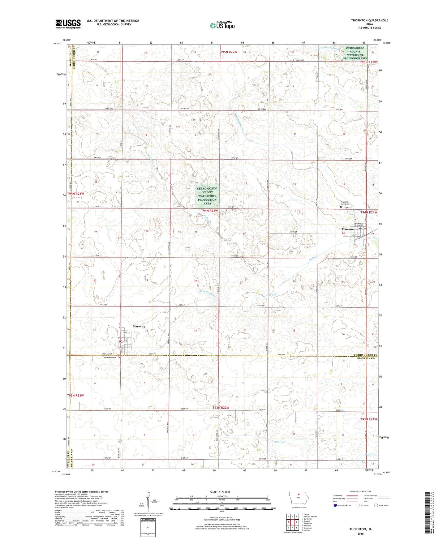
2022 topographic map quadrangle Thornton in the state of Iowa. Scale: 1:24000. Based on the newly updated USGS 7.5' US Topo map series, this map is in the following counties: Cerro Gordo, Franklin, Hancock, Wright. The map contains contour data, water features, and other items you are used to seeing on USGS maps, but also has updated roads and other features. This is the next generation of topographic maps. Printed on high-quality waterproof paper with UV fade-resistant inks.
Quads adjacent to this one:
West: Goodell
Northwest: Garner
North: Ventura Heights
Northeast: Burchinal
East: Swaledale
Southeast: Latimer
South: Alexander
Southwest: Belmond
This map covers the same area as the classic USGS quad with code o42093h4.
Contains the following named places: City of Meservey, City of Thornton, Ditch Number 57, Ditch Number 70, Ditch Number 92, Farmers Co-op Company Elevator, First Reformed Church, Flay Creek, Ingebretson Park, Meservey, Meservey Cemetery, Meservey Fire and Rescue, Meservey Post Office, Meservey Public Library, Meservey Town Hall, Meservey-Thornton Community School, Methodist Church, Pleasant Valley Golf Club, Pleasant View Cemetery, Richland Lutheran Church, Saint Paul Evangelical Lutheran Church, Thornton, Thornton Fire Department, Thornton Post Office, Thornton Public Library, Thornton Town Hall, Township of Grimes, United Methodist Church, ZIP Codes: 50457, 50479