MyTopo
George West Iowa US Topo Map
Couldn't load pickup availability
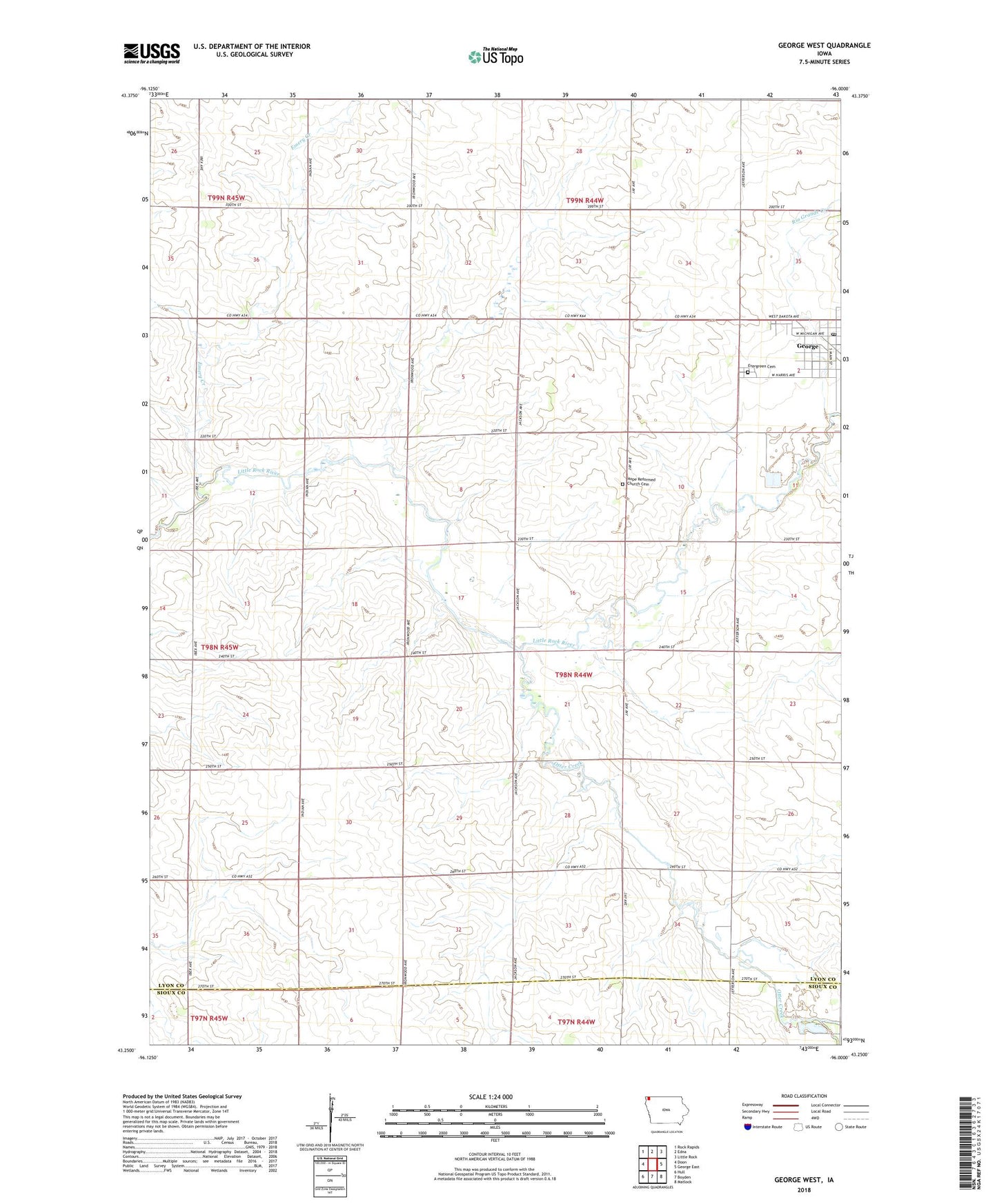
2022 topographic map quadrangle George West in the state of Iowa. Scale: 1:24000. Based on the newly updated USGS 7.5' US Topo map series, this map is in the following counties: Lyon, Sioux. The map contains contour data, water features, and other items you are used to seeing on USGS maps, but also has updated roads and other features. This is the next generation of topographic maps. Printed on high-quality waterproof paper with UV fade-resistant inks.
Quads adjacent to this one:
West: Doon
Northwest: Rock Rapids
North: Edna
Northeast: Little Rock
East: George East
Southeast: Matlock
South: Boyden
Southwest: Hull
This map covers the same area as the classic USGS quad with code o43096c1.
Contains the following named places: Boogerd Dairy, Boyden Recreation Area, Central Baptist Church, City of George, Emery Creek, Ernest Post Office, Evangelical United Methodist Church, Evergreen Cemetery, Family Health Care Building, Farmers Co-op Elevator, George, George Elevator Company Elevator, George Post Office, George Public Library, Hillside Dairy, Hope Church, Hope Reformed Church Cemetery, Kaw Farms, Otter Creek, Otter Valley Golf Course, Pioneer Medical Center, Rio Grande Creek, Saint John Lutheran Church, Township of Wheeler, United Farmers Cooperative Elevator, V and B Farms, Zoet Farms, ZIP Code: 51237