MyTopo
Wheatland Iowa US Topo Map
Couldn't load pickup availability
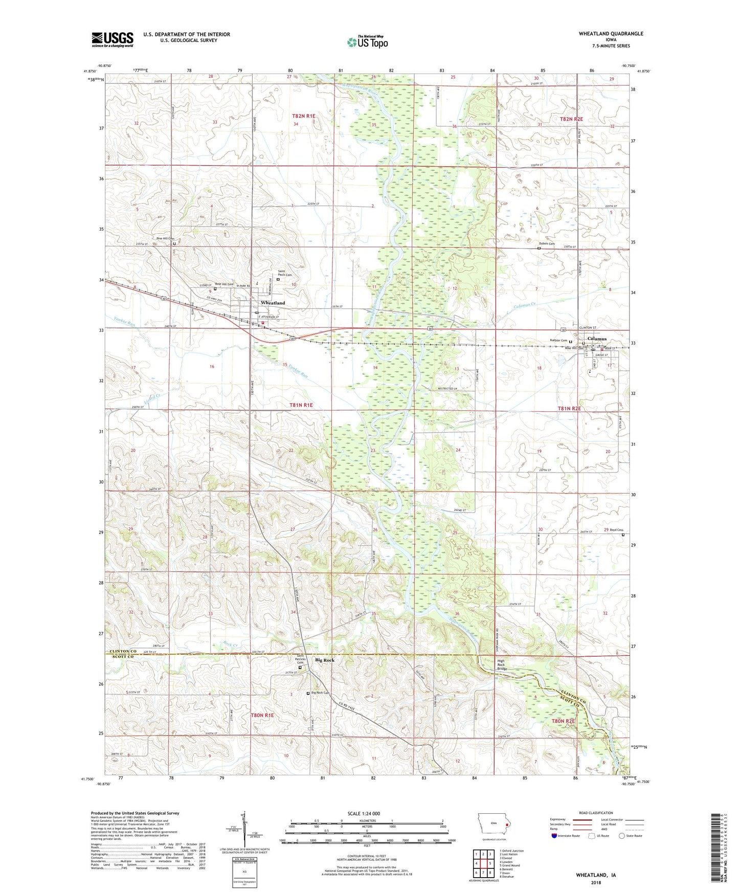
2022 topographic map quadrangle Wheatland in the state of Iowa. Scale: 1:24000. Based on the newly updated USGS 7.5' US Topo map series, this map is in the following counties: Clinton, Scott. The map contains contour data, water features, and other items you are used to seeing on USGS maps, but also has updated roads and other features. This is the next generation of topographic maps. Printed on high-quality waterproof paper with UV fade-resistant inks.
Quads adjacent to this one:
West: Lowden
Northwest: Oxford Junction
North: Lost Nation
Northeast: Elwood
East: Grand Mound
Southeast: Donahue
South: Dixon
Southwest: Bennett
This map covers the same area as the classic USGS quad with code o41090g7.
Contains the following named places: Alger Cemetery, Big Rock, Big Rock Cemetery, Big Rock Census Designated Place, Big Rock Post Office, Boyd Cemetery, Calamus, Calamus - Wheatland Elementary School, Calamus - Wheatland Junior - Senior High School, Calamus Creek, Calamus Post Office, Calamus Public Library, Calamus Volunteer Fire Department, Christian Free Lutheran Church, City of Calamus, City of Wheatland, Dubois Cemetery, Emmanuel Reformed Church, English Cemetery, Faith Lutheran Church, Hermitage Post Office, High Rock Bridge, Kuebler Cemetery, Lizard Creek, Minneyata Boy Scout Camp, Mockridge County Wildlife Preserve, Pine Hill Cemetery, Rock Creek, Rose Hill Cemetery, Saint Patrick Church, Saint Patricks Cemetery, Saint Paul's Cemetery, Saint Pauls Church, Sherman Park, Spring Rock Post Office, Syracuse State Wildlife Management Area, Township of Spring Rock, Wapsi Oaks Country Club, Wesley United Methodist Church, Wheatland, Wheatland City Hall, Wheatland Emergency Medical Services, Wheatland Fire Department, Wheatland Library, Wheatland Manor, Wheatland Post Office, Yankee Run, ZIP Code: 52777