MyTopo
Granger Iowa US Topo Map
Couldn't load pickup availability
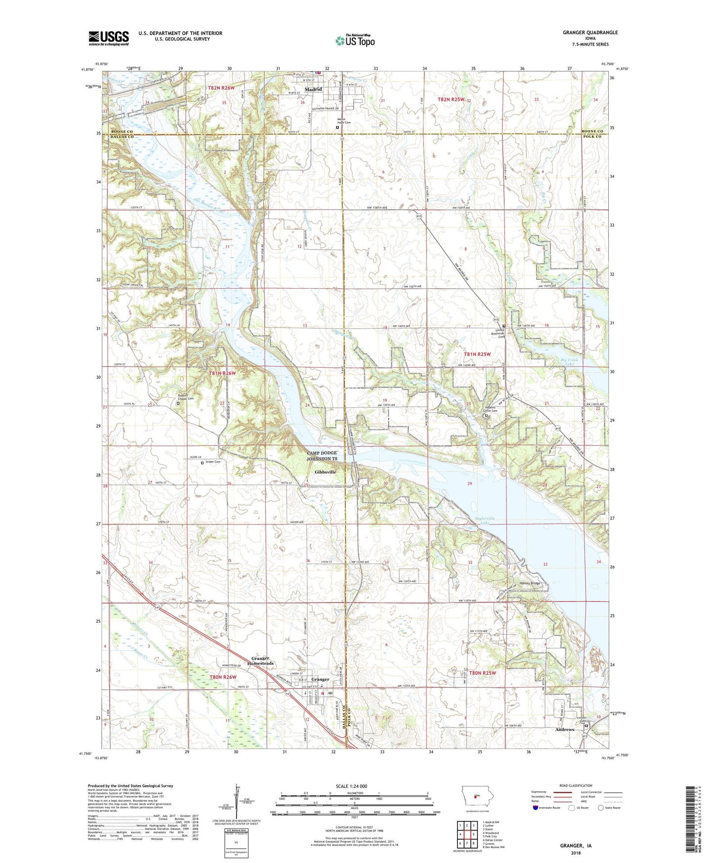
2022 topographic map quadrangle Granger in the state of Iowa. Scale: 1:24000. Based on the newly updated USGS 7.5' US Topo map series, this map is in the following counties: Polk, Dallas, Boone. The map contains contour data, water features, and other items you are used to seeing on USGS maps, but also has updated roads and other features. This is the next generation of topographic maps. Printed on high-quality waterproof paper with UV fade-resistant inks.
Quads adjacent to this one:
West: Woodward
Northwest: Madrid NW
North: Luther
Northeast: Slater
East: Polk City
Southeast: Des Moines NW
South: Grimes
Southwest: Dallas Center
This map covers the same area as the classic USGS quad with code o41093g7.
Contains the following named places: Andrews, Assumption Church, Assumption School, Big Creek State Park, City of Granger, Edgewood Park, Emmanuel United Methodist Church, Fairview School, First Christian Church, Gibbsville, Granger, Granger City Hall, Granger Fire and Rescue Department, Granger Homesteads, Granger Manor Care Center, Granger Post Office, Granger Public Library, Hanley Bridge, Hatton, Hatton Post Office, High Bridge, Hopkins Grove, Hopkins Grove Cemetery, Hopkins Grove Church, Hopkins' Grove Post Office, Jester Park, Jester Park Golf Course, Lincoln Cemetery, Lincoln Post Office, Little Creek, Madrid, Madrid Fire Department, Madrid Police Department, Mosquito Creek, Mount Hope Cemetery, Murphy Branch, Northern Light School, Prairie Creek, Preston Creek, Robbins Chapel Cemetery, Royer Creek, Scandia Bridge, Snider Cemetery, Snider School, Snyder, Snyder Bridge, Snyder Post Office, Township of Des Moines, Township of Union, United Brethren Cemetery, Woodward - Granger Elementary School, Zook Spur, ZIP Code: 50109