MyTopo
Polk City Iowa US Topo Map
Couldn't load pickup availability
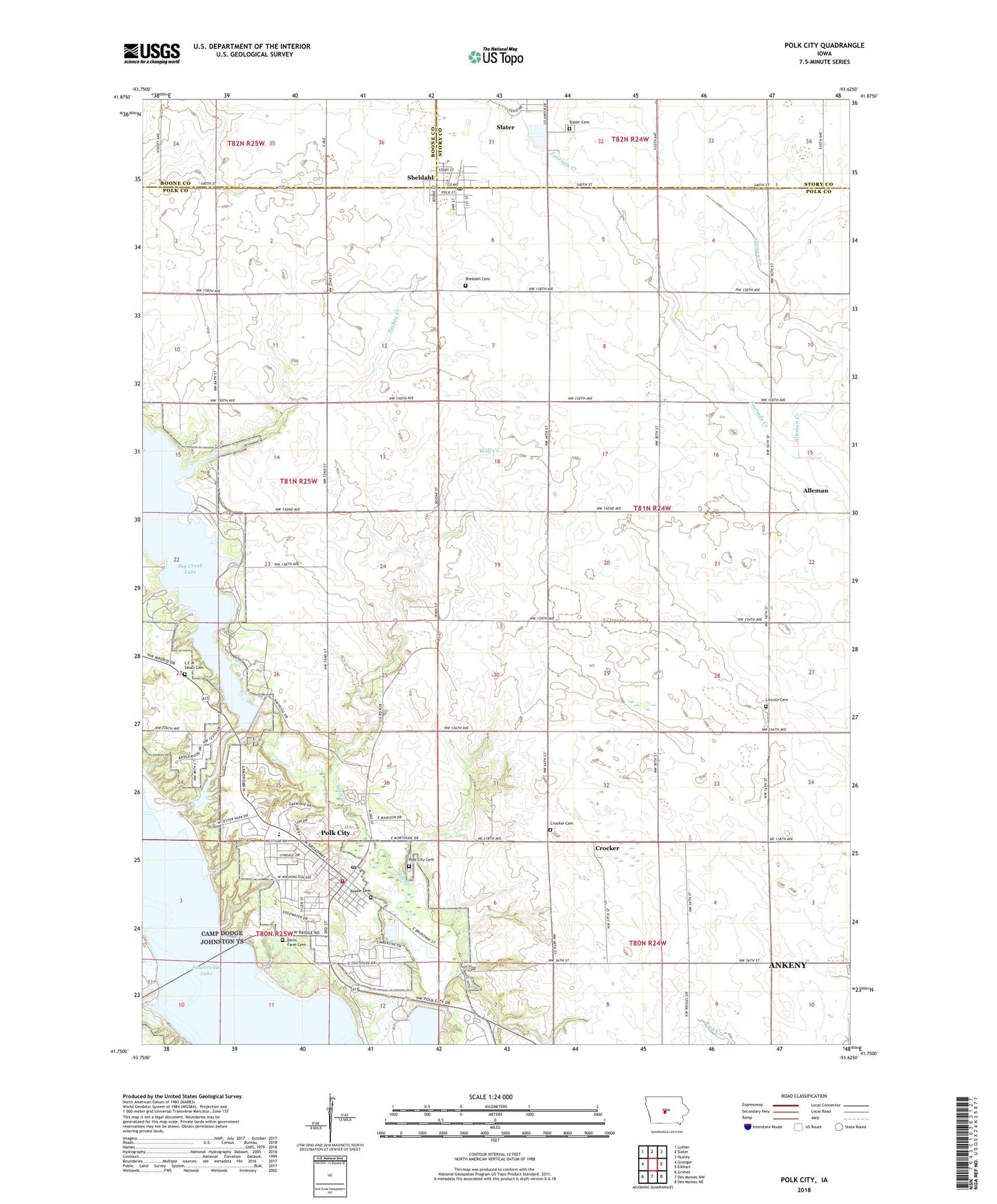
2022 topographic map quadrangle Polk City in the state of Iowa. Scale: 1:24000. Based on the newly updated USGS 7.5' US Topo map series, this map is in the following counties: Polk, Story, Boone. The map contains contour data, water features, and other items you are used to seeing on USGS maps, but also has updated roads and other features. This is the next generation of topographic maps. Printed on high-quality waterproof paper with UV fade-resistant inks.
Quads adjacent to this one:
West: Granger
Northwest: Luther
North: Slater
Northeast: Huxley
East: Elkhart
Southeast: Des Moines NE
South: Des Moines NW
Southwest: Grimes
This map covers the same area as the classic USGS quad with code o41093g6.
Contains the following named places: Adams School, All Seasons Park, Alleman Creek, Beebe Cemetery, Big Creek Barrier Dam, Big Creek Lake, Big Creek Pounding Area, Big Creek Terminal Dam, Central School, City of Polk City, City of Sheldahl, Crocker, Crocker Cemetery, Crocker Post Office, Davis Farm Cemetery, Evangelical Free Church, Franklin School, Ives School, Lem Small Cemetery, Lincoln Township Cemetery, Mayfield School, Miller Park, North Polk West Elementary School, Palmer, Palmer Post Office, Polk City, Polk City Cemetery, Polk City City Hall, Polk City Community Library, Polk City Junction, Polk City Police Department, Polk City Post Office, Polk City Volunteer Fire and Rescue Department, Saylorville Lake, School Number 4, Sheldahl, Sheldahl Cemetery, Sheldahl City Hall, Sheldahl Norwegian Lutheran Church, Sheldahl Post Office, Slater Cemetery, Township of Lincoln, Township of Madison, Turkey Creek, Ulm, Union School, United Methodist Church, Unorganized Territory of Saylorville Reservoir, Wolf Creek, ZIP Codes: 50226, 50243, 50244