MyTopo
Luther Iowa US Topo Map
Couldn't load pickup availability
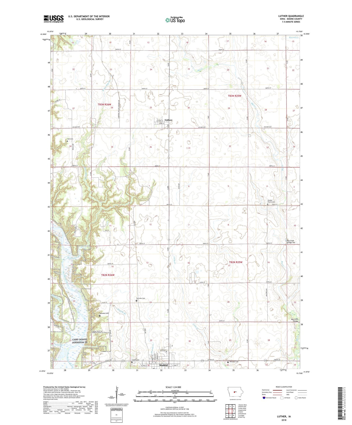
2022 topographic map quadrangle Luther in the state of Iowa. Scale: 1:24000. Based on the newly updated USGS 7.5' US Topo map series, this map is in the following counties: Boone. The map contains contour data, water features, and other items you are used to seeing on USGS maps, but also has updated roads and other features. This is the next generation of topographic maps. Printed on high-quality waterproof paper with UV fade-resistant inks.
Quads adjacent to this one:
West: Madrid NW
Northwest: Boone West
North: Boone East
Northeast: Ames West
East: Slater
Southeast: Polk City
South: Granger
Southwest: Woodward
This map covers the same area as the classic USGS quad with code o41093h7.
Contains the following named places: Belle Point Post Office, Big Creek Bridge, Big Creek Bridge Two, Camp Laurie, Cassel Cemetery, Caton Branch, Church of Christ, Church of God, Church of God Prophecy, City of Luther, City of Madrid, Clay Castle Museum, Dalander Cemetery, Eternal Life Church, Eversoll Creek, Fairview Cemetery, Family Foot Care Specialists Center, Garden Post Office, Garden Prairie, Garden Prairie Cemetery, Garden Prairie Church, Heartland Co-op Elevator, Hillsdale Cemetery, Hull Cemetery, Hull Post Office, Iowa Arboretum, Iowa State Experimental Farm, Long Refuge, Luther, Luther Post Office, Madrid, Madrid Elementary School, Madrid Home, Madrid Junior / Senior High School, Madrid Junior High School, Madrid Post Office, Madrid Public Library, Pleasant View School, Richardson Branch, Saint Johns Lutheran Church, Saint Paul United Church of Christ, Swede Point Park, Township of Colfax, Township of Douglas, Township of Garden, Township of Worth, Worth Post Office, ZIP Code: 50156