MyTopo
Hinton Iowa US Topo Map
Couldn't load pickup availability
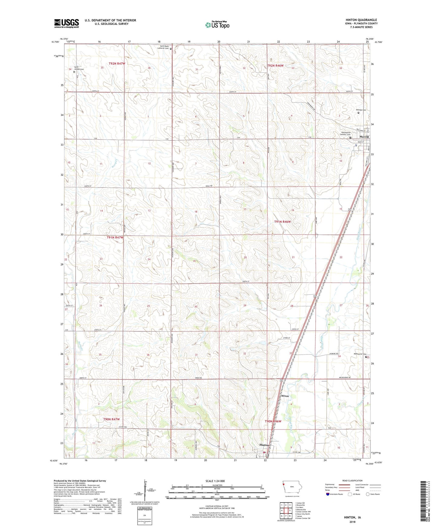
2022 topographic map quadrangle Hinton in the state of Iowa. Scale: 1:24000. Based on the newly updated USGS 7.5' US Topo map series, this map is in the following counties: Plymouth. The map contains contour data, water features, and other items you are used to seeing on USGS maps, but also has updated roads and other features. This is the next generation of topographic maps. Printed on high-quality waterproof paper with UV fade-resistant inks.
Quads adjacent to this one:
West: Millnerville
Northwest: Ireton SW
North: Brunsville
Northeast: Le Mars
East: Union Center NW
Southeast: Union Center SW
South: James
Southwest: Sioux City North
This map covers the same area as the classic USGS quad with code o42096f3.
Contains the following named places: Assumption Catholic Cemetery, Carter Creek, City of Merrill, Ellendale Post Office, Farmers Co-operative Elevator, Floyd Valley Cemetery, Grace Evangelical Church, Hillside Cemetery, Hillview Recreation Area, Hinton, Hinton High School, Hinton Middle School, Hinton Post Office, Kissinger Elementary School, Liberty School, Melbourne Church, Melbourne Post Office, Merrill Ambulance Service, Merrill Fire Department, Merrill Police Department, Merrill Public Library, Potosia, Potosia Post Office, Rosbach Post Office, Saint Johns Lutheran Church, Saint Joseph Catholic Church, Saint Joseph Cemetery, Saint Joseph Church, Saint Paul Church, Saint Pauls Lutheran Cemetery, Township of Plymouth, United Methodist Church, Wren, ZIP Code: 51038