MyTopo
Corydon NE Iowa US Topo Map
Couldn't load pickup availability
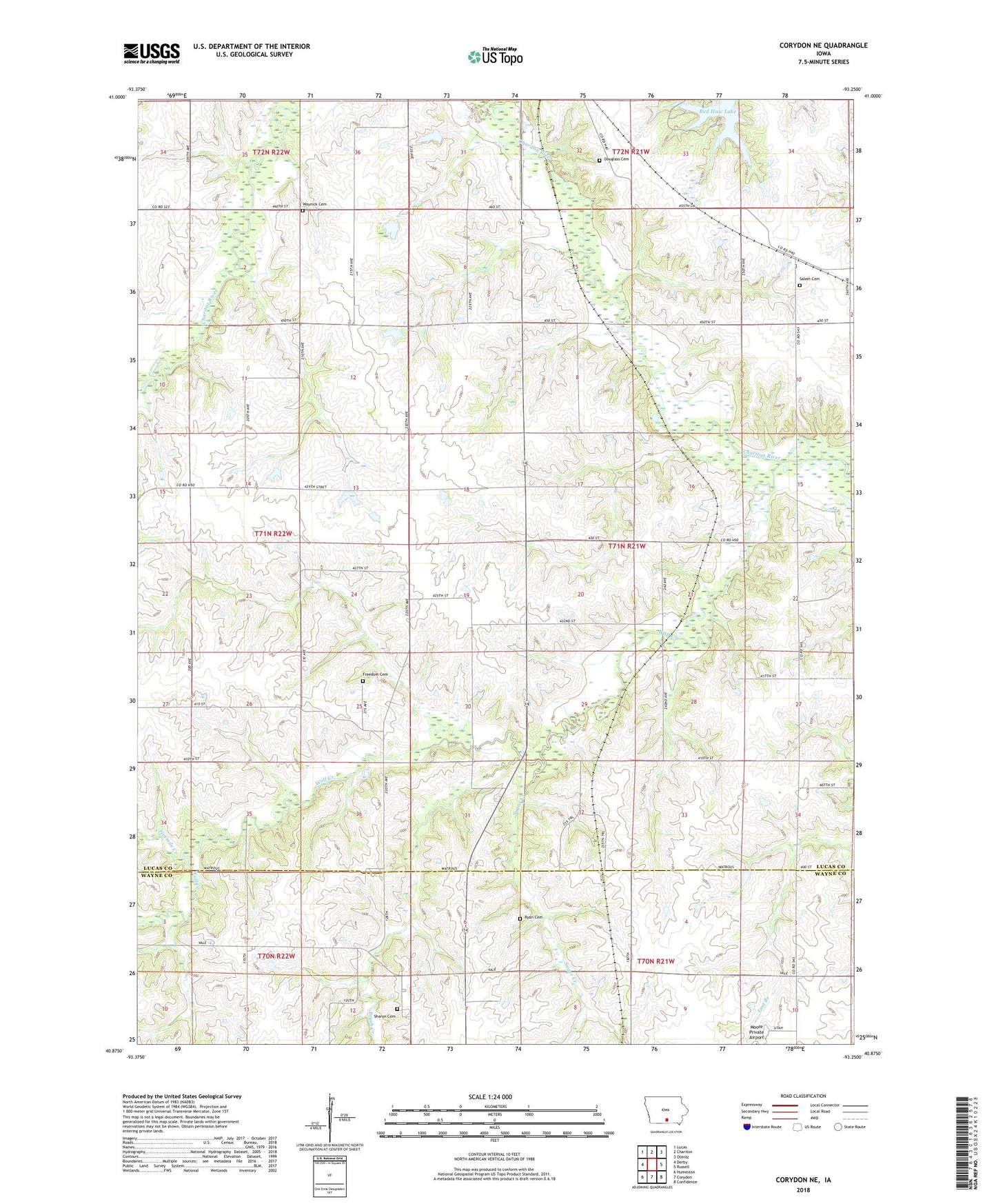
2022 topographic map quadrangle Corydon NE in the state of Iowa. Scale: 1:24000. Based on the newly updated USGS 7.5' US Topo map series, this map is in the following counties: Lucas, Wayne. The map contains contour data, water features, and other items you are used to seeing on USGS maps, but also has updated roads and other features. This is the next generation of topographic maps. Printed on high-quality waterproof paper with UV fade-resistant inks.
Quads adjacent to this one:
West: Derby
Northwest: Lucas
North: Chariton
Northeast: Olmitz
East: Russell
Southeast: Confidence
South: Corydon
Southwest: Humeston
This map covers the same area as the classic USGS quad with code o40093h3.
Contains the following named places: Braden School, Brush Creek, Cinder Marsh Park, Douglass Cemetery, Fivemile Creek, Freedom Camp, Freedom Cemetery, Freedom Post Office, Freedom School, Harmony School, Harts Mill Creek, Honey Creek, Jack Coffey Memorial Library, Lincoln School, Mayflower School, Milan Post Office, Moore Private Airport, Myers School, Otterbein Church, Palmer School, Pin Oak Marsh, Pin Oak Marsh Lodge Educational Center, Red Haw Lake, Red Haw State Park, Ryan Cemetery, Salem Cemetery, Salem Church, Salem School, Sharon Cemetery, Sharon Church, Sugar Creek, Township of Benton, Union School, Washington School, Waynick Cemetery, Wolf Creek