MyTopo
Ionia Iowa US Topo Map
Couldn't load pickup availability
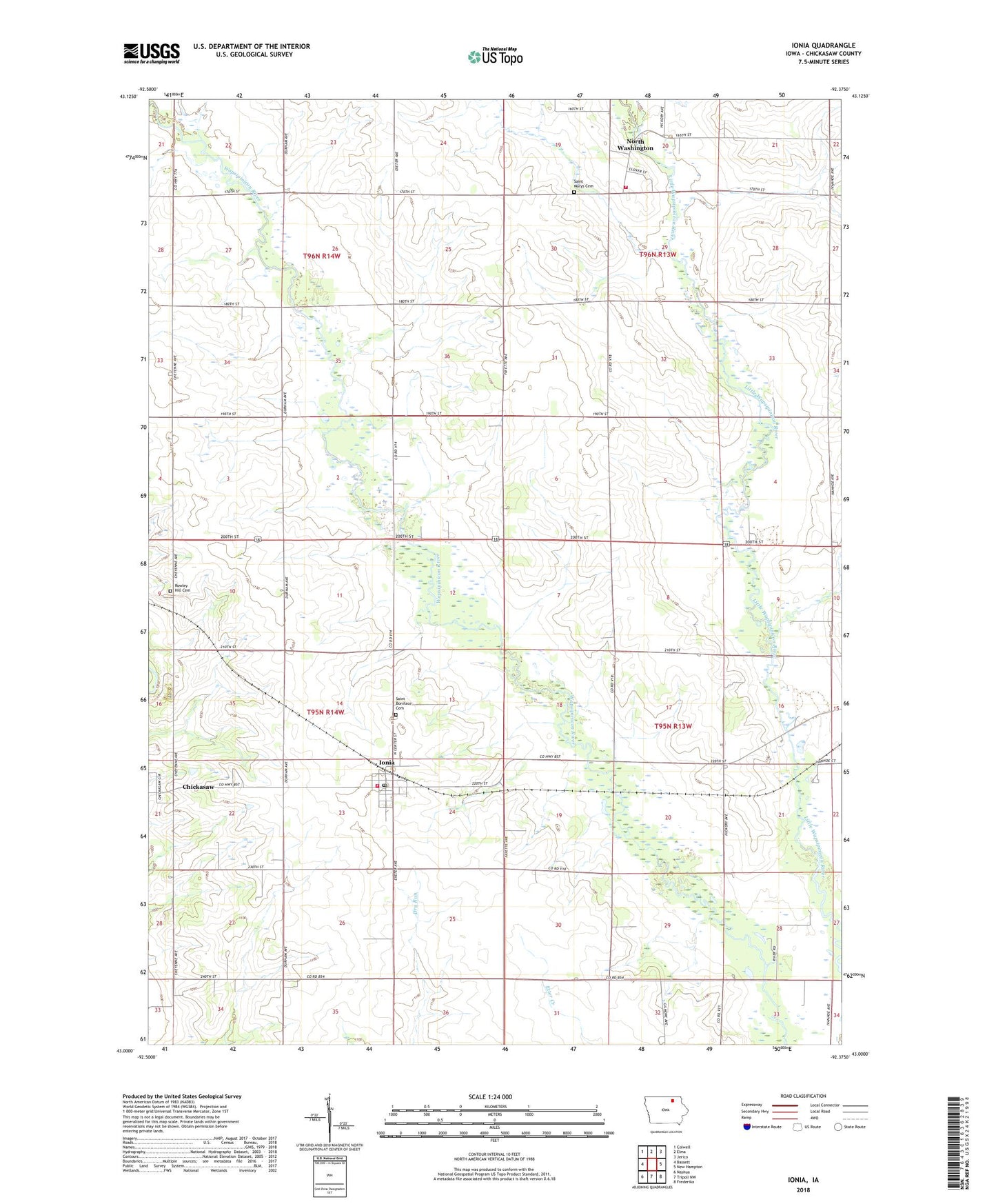
2022 topographic map quadrangle Ionia in the state of Iowa. Scale: 1:24000. Based on the newly updated USGS 7.5' US Topo map series, this map is in the following counties: Chickasaw. The map contains contour data, water features, and other items you are used to seeing on USGS maps, but also has updated roads and other features. This is the next generation of topographic maps. Printed on high-quality waterproof paper with UV fade-resistant inks.
Quads adjacent to this one:
West: Bassett
Northwest: Colwell
North: Elma
Northeast: Jerico
East: New Hampton
Southeast: Frederika
South: Tripoli NW
Southwest: Nashua
This map covers the same area as the classic USGS quad with code o43092a4.
Contains the following named places: Chickasaw, Chickasaw Post Office, City of Ionia, City of North Washington, Haus Park, Ionia, Ionia Community Library, Ionia Fire Department, Ionia Post Office, Jenn Timber Park, Mount Carroll Cemetery, North Washington, North Washington Fire Department, North Washington Post Office, North Waspi Access, Saint Boniface Cemetery, Saint Marys Cemetery, Stoltz Addition Park, Township of Chickasaw, Township of Dayton, Twin Pond Park, Wapsie Access Area, ZIP Code: 50645