MyTopo
Kinross Iowa US Topo Map
Couldn't load pickup availability
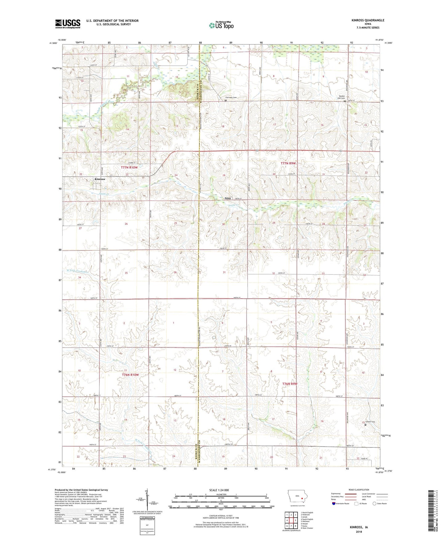
2022 topographic map quadrangle Kinross in the state of Iowa. Scale: 1:24000. Based on the newly updated USGS 7.5' US Topo map series, this map is in the following counties: Washington, Keokuk. The map contains contour data, water features, and other items you are used to seeing on USGS maps, but also has updated roads and other features. This is the next generation of topographic maps. Printed on high-quality waterproof paper with UV fade-resistant inks.
Quads adjacent to this one:
West: South English
Northwest: North English
North: Holbrook
Northeast: Amish
East: Wellman
Southeast: West Chester
South: Keota
Southwest: Harper
This map covers the same area as the classic USGS quad with code o41091d8.
Contains the following named places: Bunker Hill Cemetery, Center Cemetery, Chandler Post Office, City of Kinross, Fairview Cemetery, Kinross, Kinross Post Office, Little Creek, Nira, Nira Post Office, Seventy Six Centre Post Office, Township of Seventy-Six, Wassonville