MyTopo
La Motte Iowa US Topo Map
Couldn't load pickup availability
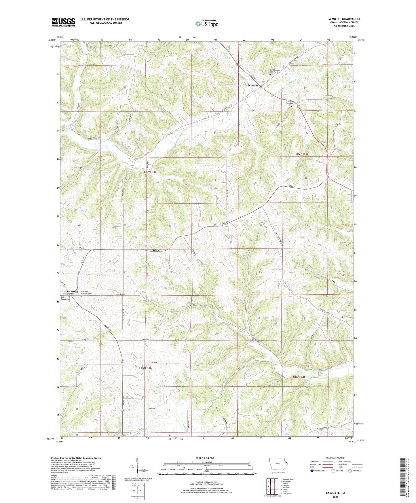
2022 topographic map quadrangle La Motte in the state of Iowa. Scale: 1:24000. Based on the newly updated USGS 7.5' US Topo map series, this map is in the following counties: Jackson. The map contains contour data, water features, and other items you are used to seeing on USGS maps, but also has updated roads and other features. This is the next generation of topographic maps. Printed on high-quality waterproof paper with UV fade-resistant inks.
Quads adjacent to this one:
West: Zwingle
Northwest: Dubuque South
North: Menominee
Northeast: Galena
East: Bellevue
Southeast: Springbrook
South: Andrew
Southwest: Fulton
This map covers the same area as the classic USGS quad with code o42090c5.
Contains the following named places: Big Mill Creek Public Hunting Area, City of La Motte, City of Saint Donatus, East Hill Cemetery, Freedom Field, Hoff Airport, Holy Rosary Parish, La Motte, La Motte Fire and Rescue, La Motte Post Office, Lux Creek, Saint Donatus, Saint Donatus Catholic Cemetery, Saint Donatus Catholic Church, Saint Donatus Post Office, Saint Donatus Town Hall, Saint Johns Church, Saint John's Lutheran Cemetery, Tete De Mort Post Office, Township of Prairie Springs, Township of Richland, Way of the Cross