MyTopo
Woodburn Iowa US Topo Map
Couldn't load pickup availability
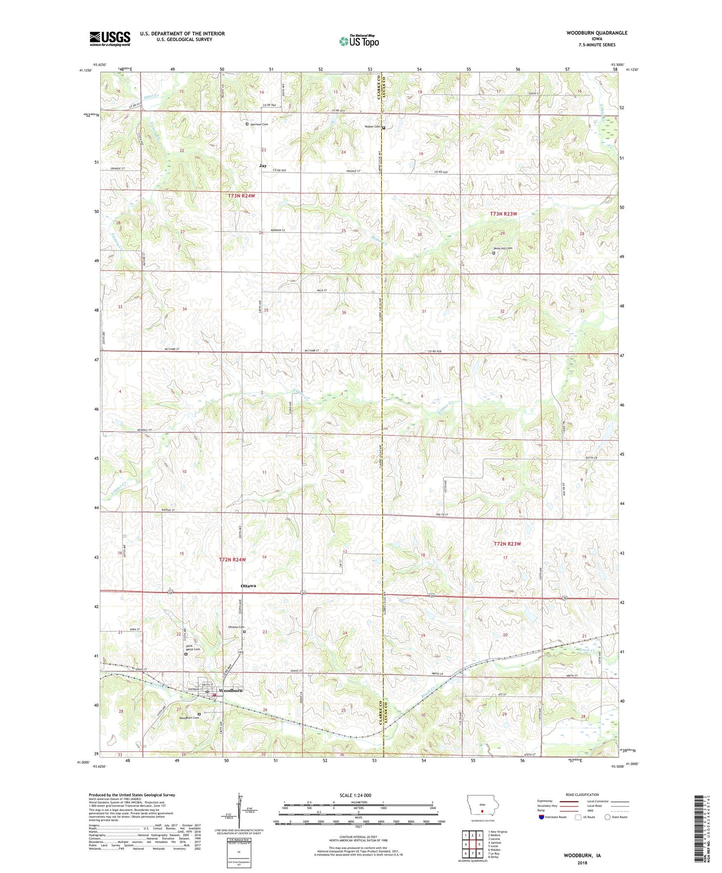
2022 topographic map quadrangle Woodburn in the state of Iowa. Scale: 1:24000. Based on the newly updated USGS 7.5' US Topo map series, this map is in the following counties: Clarke, Lucas. The map contains contour data, water features, and other items you are used to seeing on USGS maps, but also has updated roads and other features. This is the next generation of topographic maps. Printed on high-quality waterproof paper with UV fade-resistant inks.
Quads adjacent to this one:
West: Jamison
Northwest: New Virginia
North: Medora
Northeast: Lacona
East: Lucas
Southeast: Derby
South: Le Roy
Southwest: Weldon
This map covers the same area as the classic USGS quad with code o41093a5.
Contains the following named places: Box Elder School, Brush Creek, Center Star School, Chinquapin School, City of Woodburn, Cleveland, Cleveland Post Office, Fox School, Harrison Cemetery, Hill School, Jacksonville, Jay, Jay Post Office, Liberty Center School, Middleport Post Office, North Star School, Ottawa, Ottawa Cemetery, Ottawa School, Palestine School, Pleasant Ridge School, Powell School, Saint Marys Cemetery, Spring Hill School, Township of Jackson, Township of Liberty, Victor School, Victory Creek, Walker Cemetery, Woodburn, Woodburn Cemetery, Woodburn Christian Church, Woodburn City Hall, Woodburn Fire and Rescue Department, Woodburn Post Office, Wren Hill Cemetery, Wren School, ZIP Codes: 50151, 50275