MyTopo
Lucas Iowa US Topo Map
Couldn't load pickup availability
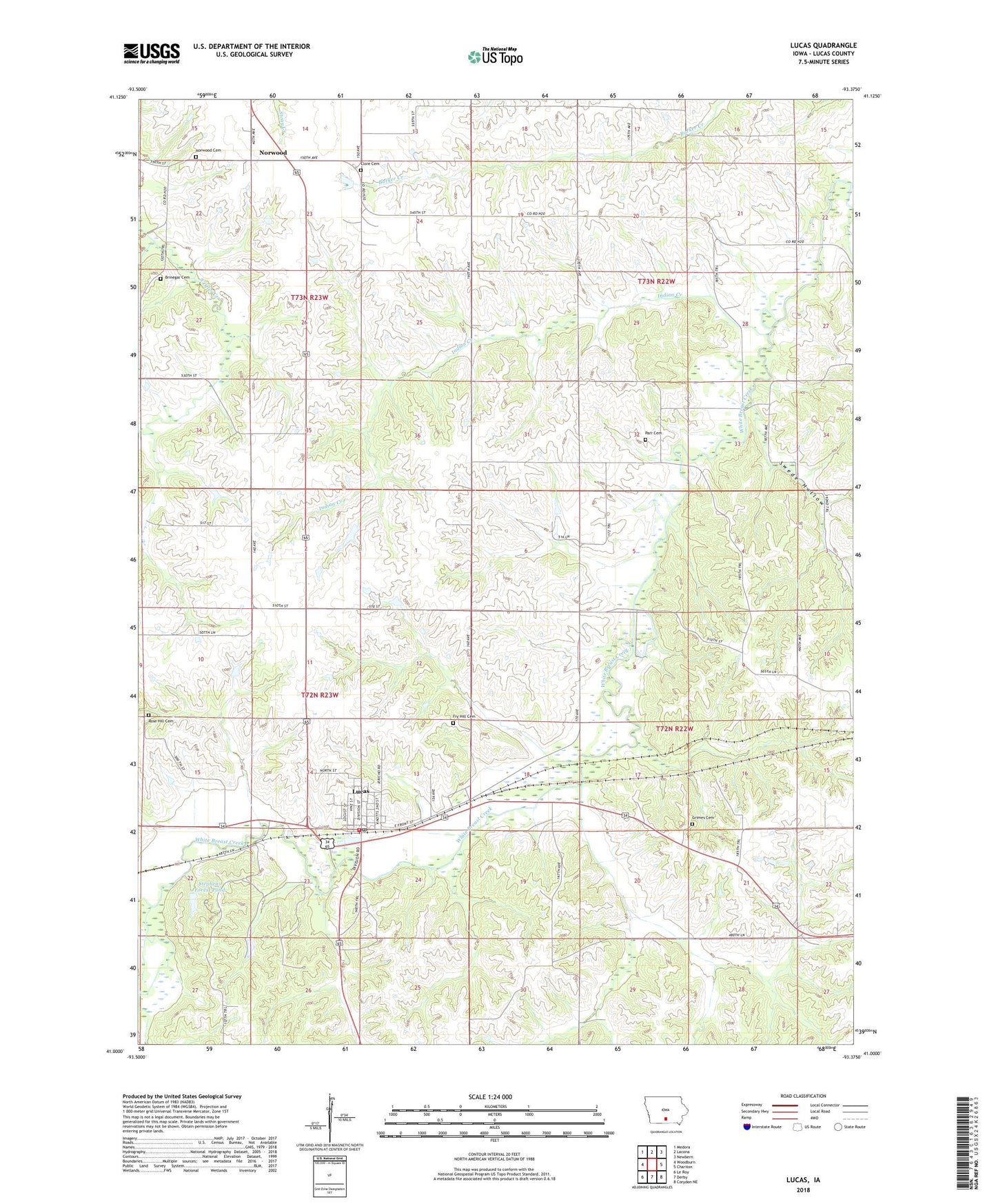
2022 topographic map quadrangle Lucas in the state of Iowa. Scale: 1:24000. Based on the newly updated USGS 7.5' US Topo map series, this map is in the following counties: Lucas. The map contains contour data, water features, and other items you are used to seeing on USGS maps, but also has updated roads and other features. This is the next generation of topographic maps. Printed on high-quality waterproof paper with UV fade-resistant inks.
Quads adjacent to this one:
West: Woodburn
Northwest: Medora
North: Lacona
Northeast: Newbern
East: Chariton
Southeast: Corydon NE
South: Derby
Southwest: Le Roy
This map covers the same area as the classic USGS quad with code o41093a4.
Contains the following named places: Brinegar Cemetery, Broadhead Woods Park, Burlington Park and Caboose, Cackler School, Center School, City of Lucas, Fry Hill Cemetery, Gettinger School, Grimes Cemetery, Harmony School, Indian Creek, Iowa High School Rodeo Association Rescue Unit, Jericho Hills Campground, John L Lewis Mining and Labor Museum, John L Lewis Park, John L Lewis State Historical Marker, Lucas, Lucas Assembly of God Church, Lucas City Hall, Lucas Elementary School, Lucas Mall, Lucas Post Office, Lucas Presbyterian Church, Lucas Volunteer Fire Department, Morgan School, Mouse Creek, Norwood, Norwood Assembly of God Church, Norwood Cemetery, Norwood Post Office, Norwood United Methodist Church, Parr Wheeler Pioneer Cemetery, Plymton School, Prairie View School, Rose Hill Cemetery, Stephens Forest Pond, Stephens Forest Pond Dam, Stephens State Forest - Lucas Unit, Stewart School, Swede Hollow, Tallahoma Post Office, Township of Jackson, Township of Liberty, Township of Otter Creek, Township of Whitebreast, Troy, Vawter School, Wells Pioneer Cemetery