MyTopo
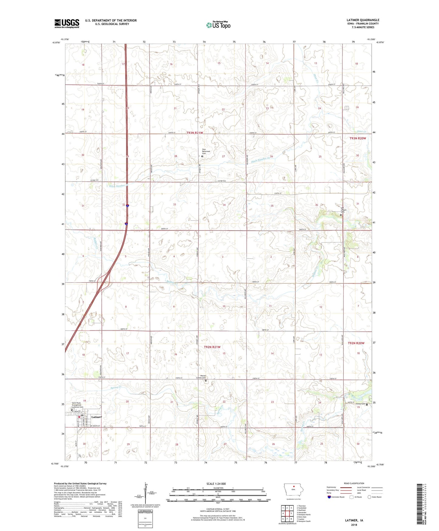
Latimer Iowa US Topo Map
Couldn't load pickup availability
2022 topographic map quadrangle Latimer in the state of Iowa. Scale: 1:24000. Based on the newly updated USGS 7.5' US Topo map series, this map is in the following counties: Franklin. The map contains contour data, water features, and other items you are used to seeing on USGS maps, but also has updated roads and other features. This is the next generation of topographic maps. Printed on high-quality waterproof paper with UV fade-resistant inks.
Quads adjacent to this one:
West: Alexander
Northwest: Thornton
North: Swaledale
Northeast: Sheffield
East: Hampton North
Southeast: Hampton South
South: Coulter
Southwest: Dows East
This map covers the same area as the classic USGS quad with code o42093g3.
Contains the following named places: CAL Community Junior High School / High School, CAL Elementary School, City of Latimer, Ditch Number 55, Farmers Co-op Elevator, Franklin Medical Center, Immanuel United Church of Christ, Latimer, Latimer Golf Club, Latimer Post Office, Latimer Rural Fire Department, Latimer Town Hall, Longdpun Habitat Area - Lukes Wetland, Marion Center Cemetery, Old Chapin Cemetery, Saint Paul Lutheran Church, Saint Pauls Evangelical Lutheran Cemetery, Saint Paul's Lutheran School, Site of 1857 Hotel Historical Marker, Spring Creek Wildlife Area, Township of Marion, Township of Richland, Trinity Lutheran Cemetery, West Franklin First Responders, Zion Church, Zion Reformed Cemetery, ZIP Code: 50452