MyTopo
Coulter Iowa US Topo Map
Couldn't load pickup availability
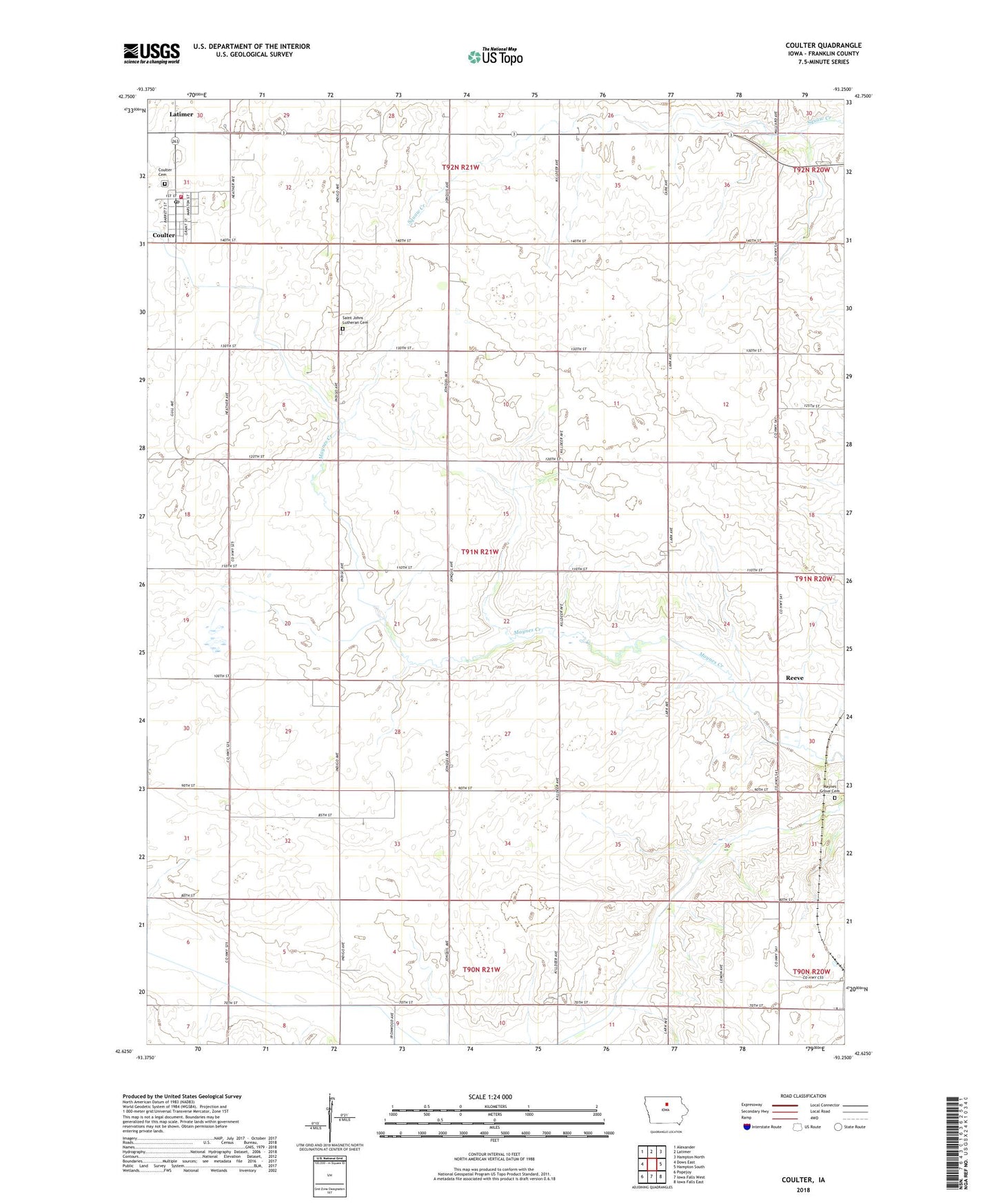
2023 topographic map quadrangle Coulter in the state of Iowa. Scale: 1:24000. Based on the newly updated USGS 7.5' US Topo map series, this map is in the following counties: Franklin. The map contains contour data, water features, and other items you are used to seeing on USGS maps, but also has updated roads and other features. This is the next generation of topographic maps. Printed on high-quality waterproof paper with UV fade-resistant inks.
Quads adjacent to this one:
West: Dows East
Northwest: Alexander
North: Latimer
Northeast: Hampton North
East: Hampton South
Southeast: Iowa Falls East
South: Iowa Falls West
Southwest: Popejoy
This map covers the same area as the classic USGS quad with code o42093f3.
Contains the following named places: Bradford Census Designated Place, City of Coulter, Congress Post Office, Coulter, Coulter Cemetery, Coulter Community Center, Coulter Post Office, Coulter Public Library, Coulter Town Hall, Coulter Volunteer Fire Department, Franklin County, Maynes Grove Cemetery, Nazareth Lutheran Church, Reeve, Saint Johns Church, Saint Johns Lutheran Cemetery, Township of Hamilton, Washington, ZIP Code: 50431