MyTopo
Le Grand Iowa US Topo Map
Couldn't load pickup availability
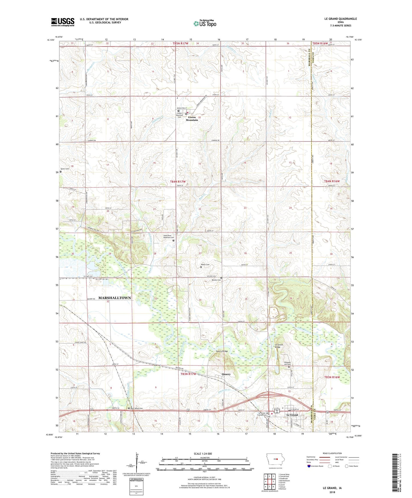
2022 topographic map quadrangle Le Grand in the state of Iowa. Scale: 1:24000. Based on the newly updated USGS 7.5' US Topo map series, this map is in the following counties: Marshall, Tama. The map contains contour data, water features, and other items you are used to seeing on USGS maps, but also has updated roads and other features. This is the next generation of topographic maps. Printed on high-quality waterproof paper with UV fade-resistant inks.
Quads adjacent to this one:
West: Marshalltown
Northwest: Conrad West
North: Conrad East
Northeast: Gladbrook
East: Garwin
Southeast: Montour
South: Gilman
Southwest: Laurel
This map covers the same area as the classic USGS quad with code o42092a7.
Contains the following named places: Bowles Cemetery, Chapel Hill Church, City of Le Grand, Davisons Creek, East Marshall High School, Friends Church, GMG Elementary School, Gowanda Post Office, Green Mountain, Green Mountain Cemetery, Green Mountain Census Designated Place, Green Mountain First Responders, Green Mountain Post Office, Iowa River Brethren Cemetery, Iowa River Church, Le Grand, Le Grand Bridge, Le Grand Elevator Company Elevator, Le Grand Fire Department and Emergency Medical Services, Le Grand Friends Cemetery, Le Grand Pioneer Heritage Library, Le Grand Post Office, Linn Creek, Marion Township Fire Department and Emergency Medical Serveice, Nickolson Creek, Pleasant Hill Cemetery, Predonia, Quarry, Quarry Bridge, Quarry Post Office, Quinn Cemetery, Reedsville Post Office, Rock Creek, Rock Valley Cemetery, Rockton, Rockton Post Office, Shady Oaks RV Campground, South Rock Creek, Terrace Manor Mobile Home Court, Three Bridges County Park, Timber Creek, Township of Marion, United Church of Christ, Wallin Cemetery, ZIP Code: 50142