MyTopo
Lincoln Iowa US Topo Map
Couldn't load pickup availability
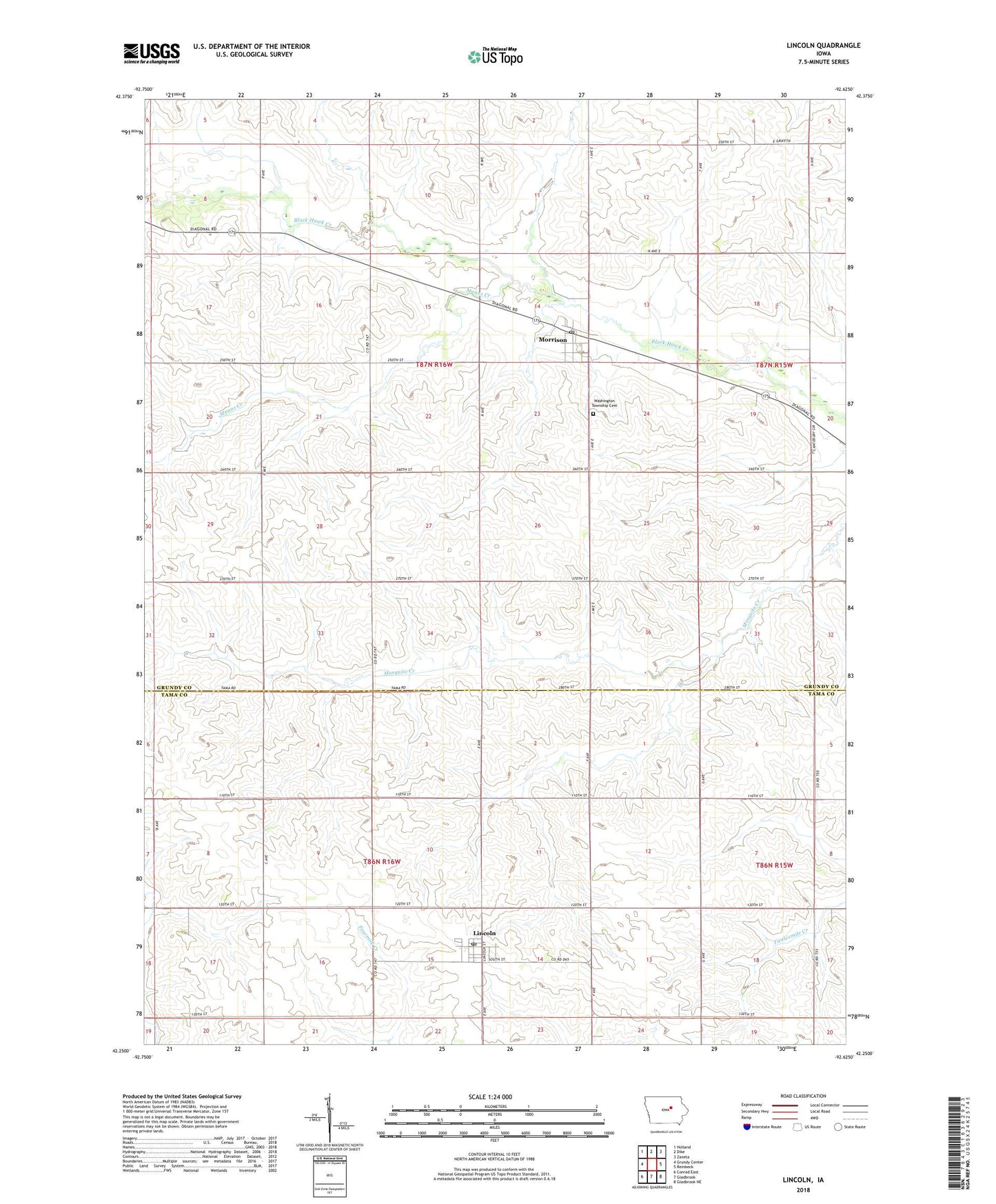
2022 topographic map quadrangle Lincoln in the state of Iowa. Scale: 1:24000. Based on the newly updated USGS 7.5' US Topo map series, this map is in the following counties: Grundy, Tama. The map contains contour data, water features, and other items you are used to seeing on USGS maps, but also has updated roads and other features. This is the next generation of topographic maps. Printed on high-quality waterproof paper with UV fade-resistant inks.
Quads adjacent to this one:
West: Grundy Center
Northwest: Holland
North: Dike
Northeast: Zaneta
East: Reinbeck
Southeast: Gladbrook NE
South: Gladbrook
Southwest: Conrad East
This map covers the same area as the classic USGS quad with code o42092c6.
Contains the following named places: Berlin, Black Hawk Creek Wildlife Center, Central Counties Co-op Elevator, City of Lincoln, City of Morrison, Coldville Post Office, Colfax Number Three School, Grundy County Museum, Gutknecht Roadside Park, Lincoln, Lincoln City Hall, Lincoln Post Office, Minnehaha Creek, Morrison, Morrison Post Office, Munns Creek, Oakleaf Golf and Country Club, Pioneer Trail, Salem Church of Lincoln, Shearin Park, Township of Lincoln, Township of Washington, Washington Township Cemetery, Wolfe Family Preserve, ZIP Code: 50652