MyTopo
Dike Iowa US Topo Map
Couldn't load pickup availability
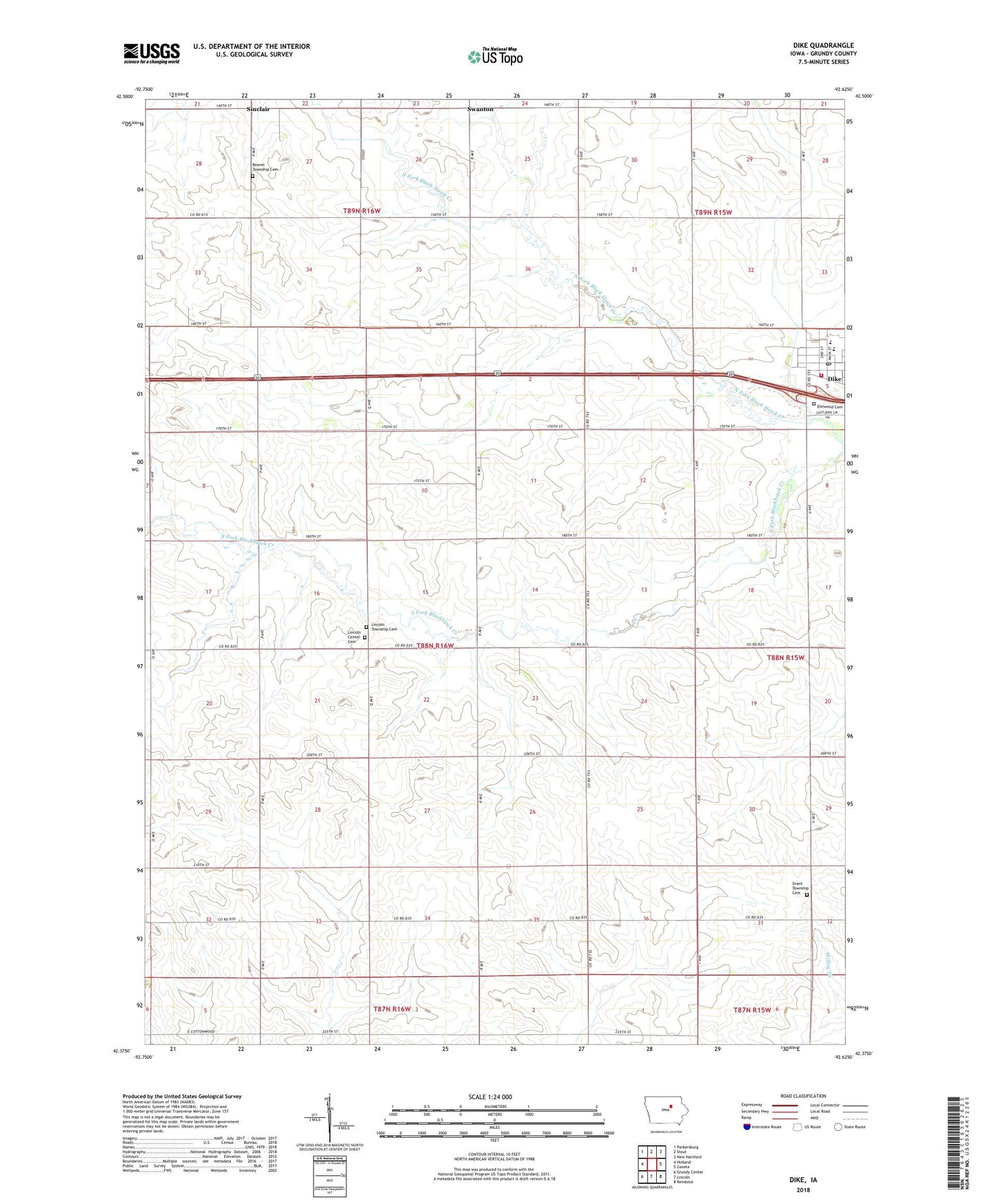
2022 topographic map quadrangle Dike in the state of Iowa. Scale: 1:24000. Based on the newly updated USGS 7.5' US Topo map series, this map is in the following counties: Grundy. The map contains contour data, water features, and other items you are used to seeing on USGS maps, but also has updated roads and other features. This is the next generation of topographic maps. Printed on high-quality waterproof paper with UV fade-resistant inks.
Quads adjacent to this one:
West: Holland
Northwest: Parkersburg
North: Stout
Northeast: New Hartford
East: Zaneta
Southeast: Reinbeck
South: Lincoln
Southwest: Grundy Center
This map covers the same area as the classic USGS quad with code o42092d6.
Contains the following named places: Arrow Post Office, Beaver Township Cemetery, City of Dike, Dairyville, Dairyville Post Office, Dike, Dike - New Hartford High School, Dike City Hall, Dike Elementary School, Dike Fire Department and Rescue, Dike Post Office, Dike Public Library, Elmwood Cemetery, Farmers Cooperative Company Elevator, Grant Township Cemetery, KGCI-FM (Grundy Center), Liberty Baptist Church, Lincoln, Lincoln Centre Post Office, Lincoln Township Cemetery, Roadman Memorial Park, Saint Mary's Catholic Church, Sinclair, South Fork Blackhawk Creek, Swanton, Township of Lincoln, Triple J Airport, United Methodist Church, ZIP Code: 50624