MyTopo
Princeton Missouri US Topo Map
Couldn't load pickup availability
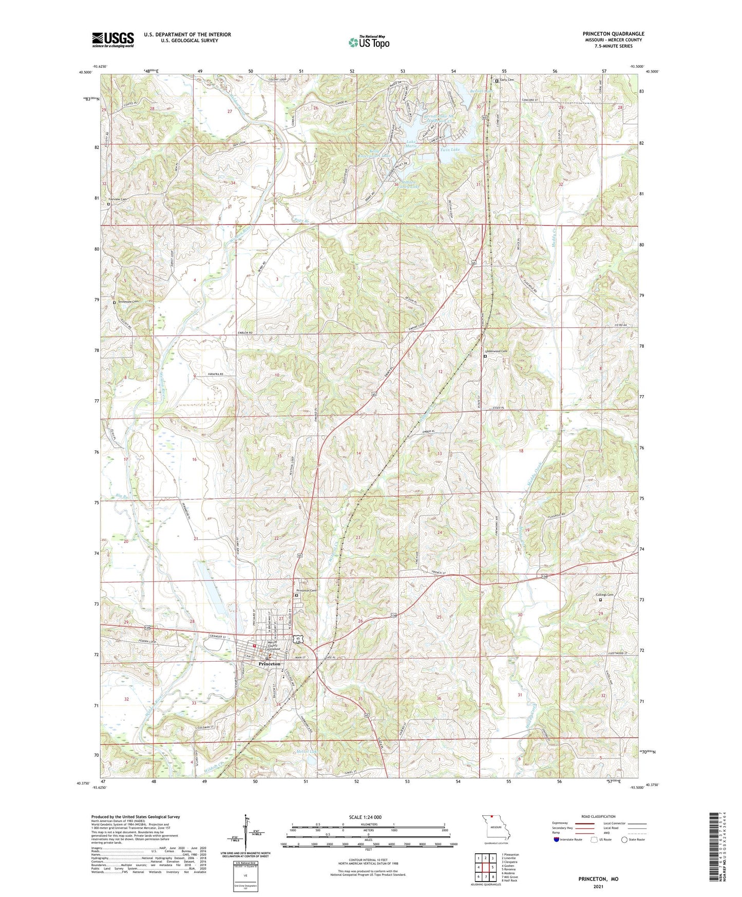
2021 topographic map quadrangle Princeton in the state of Missouri. Scale: 1:24000. Based on the newly updated USGS 7.5' US Topo map series, this map is in the following counties: Mercer. The map contains contour data, water features, and other items you are used to seeing on USGS maps, but also has updated roads and other features. This is the next generation of topographic maps. Printed on high-quality waterproof paper with UV fade-resistant inks.
Quads adjacent to this one:
West: Goshen
Northwest: Pleasanton
North: Lineville
Northeast: Cleopatra
East: Ravanna
Southeast: Half Rock
South: Mill Grove
Southwest: Modena
This map covers the same area as the classic USGS quad with code o40093d5.
Contains the following named places: Alvord, Ballast Pit Lake, Berndt Lake, Berndt Lake Dam, Berndt Lake NE SE Section 25, Berndt Lake NE SE Section 25 Dam, Berndt Lake SW SW Section 30, Berndt Lake SW SW Section 30 Dam, Big Branch, City of Princeton, Collings Cemetery, Early Cemetery, Early School, East Fork Church, East White School, Fairly School, Fairview Cemetery, Fairview Church, Greenwood School, Hidden Valley Lake, Hidden Valley Lake Dam, Kelly Enterprises Lake, Kelly Enterprises Lake Dam, Lake Marie, Lake Marie Dam, Little River, Lower Girdner School, Meisel Lake, Meisel Lake Dam, Mercer County, Mercer County Fire Protection District, Mercer County Home, Mercer County Sheriff's Office, Mercer Lake, Pops Branch, Princeton, Princeton Cemetery, Princeton Elementary School, Princeton Junior Senior High School, Princeton Post Office, Princeton-Kauffman Memorial Airport, Shook School, Spencer School, Township of Morgan, Twin Lake, Twin Lake Dam, Underwood Cemetery, Upper Tennessee School, Wayman Lakes, Wayman School, Wildcat Creek