MyTopo
Pisgah Iowa US Topo Map
Couldn't load pickup availability
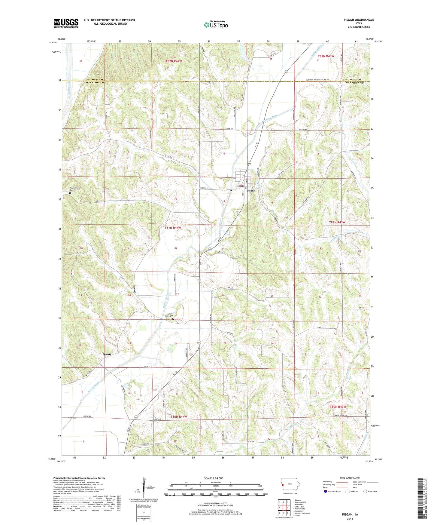
2022 topographic map quadrangle Pisgah in the state of Iowa. Scale: 1:24000. Based on the newly updated USGS 7.5' US Topo map series, this map is in the following counties: Harrison, Monona. The map contains contour data, water features, and other items you are used to seeing on USGS maps, but also has updated roads and other features. This is the next generation of topographic maps. Printed on high-quality waterproof paper with UV fade-resistant inks.
Quads adjacent to this one:
West: Little Sioux
Northwest: Blencoe
North: Moorhead NW
Northeast: Moorhead
East: Moorhead SE
Southeast: Logan
South: Missouri Valley NW
Southwest: Mondamin
This map covers the same area as the classic USGS quad with code o41095g8.
Contains the following named places: City of Pisgah, Cobb Creek, Fountainbleau Cemetery, Loess Hills State Forest, Loess Hills State Forest Service Office, Orson, Orson Post Office, Pisgah, Pisgah City Hall, Pisgah Fire Department, Pisgah Methodist Church, Pisgah Post Office, Reorganized Church of Jesus Christ of Latter Day Saints, Soldier Valley, Soldier Valley Cemetery, Soldier Valley Post Office, Stowe Creek, Township of Jackson, United Pentecostal Church, ZIP Code: 51564