MyTopo
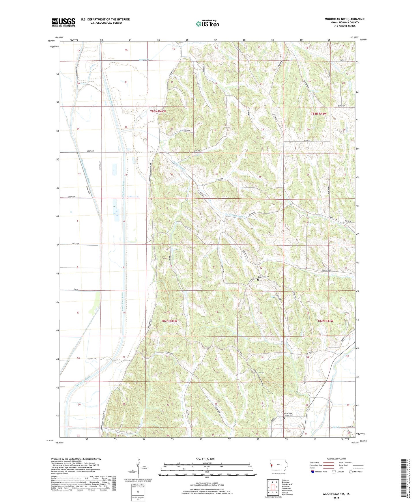
Moorhead NW Iowa US Topo Map
Couldn't load pickup availability
2022 topographic map quadrangle Moorhead NW in the state of Iowa. Scale: 1:24000. Based on the newly updated USGS 7.5' US Topo map series, this map is in the following counties: Monona. The map contains contour data, water features, and other items you are used to seeing on USGS maps, but also has updated roads and other features. This is the next generation of topographic maps. Printed on high-quality waterproof paper with UV fade-resistant inks.
Quads adjacent to this one:
West: Blencoe
Northwest: Onawa
North: Castana
Northeast: Mapleton SE
East: Moorhead
Southeast: Moorhead SE
South: Pisgah
Southwest: Little Sioux
This map covers the same area as the classic USGS quad with code o41095h8.
Contains the following named places: Beaver Creek, Belvidere Post Office, Bethesda Cemetery, Cottonwood Creek, Hall Creek, Hall Creek Post Office, Hiawatha Post Office, Ingemann Church, Maple River, Monona Harrison Ditch, Preparation, Preparation Canyon Cemetery, Preparation Canyon State Park, Preparation Post Office, Township of Belvidere, Township of Sioux