MyTopo
Livermore Iowa US Topo Map
Couldn't load pickup availability
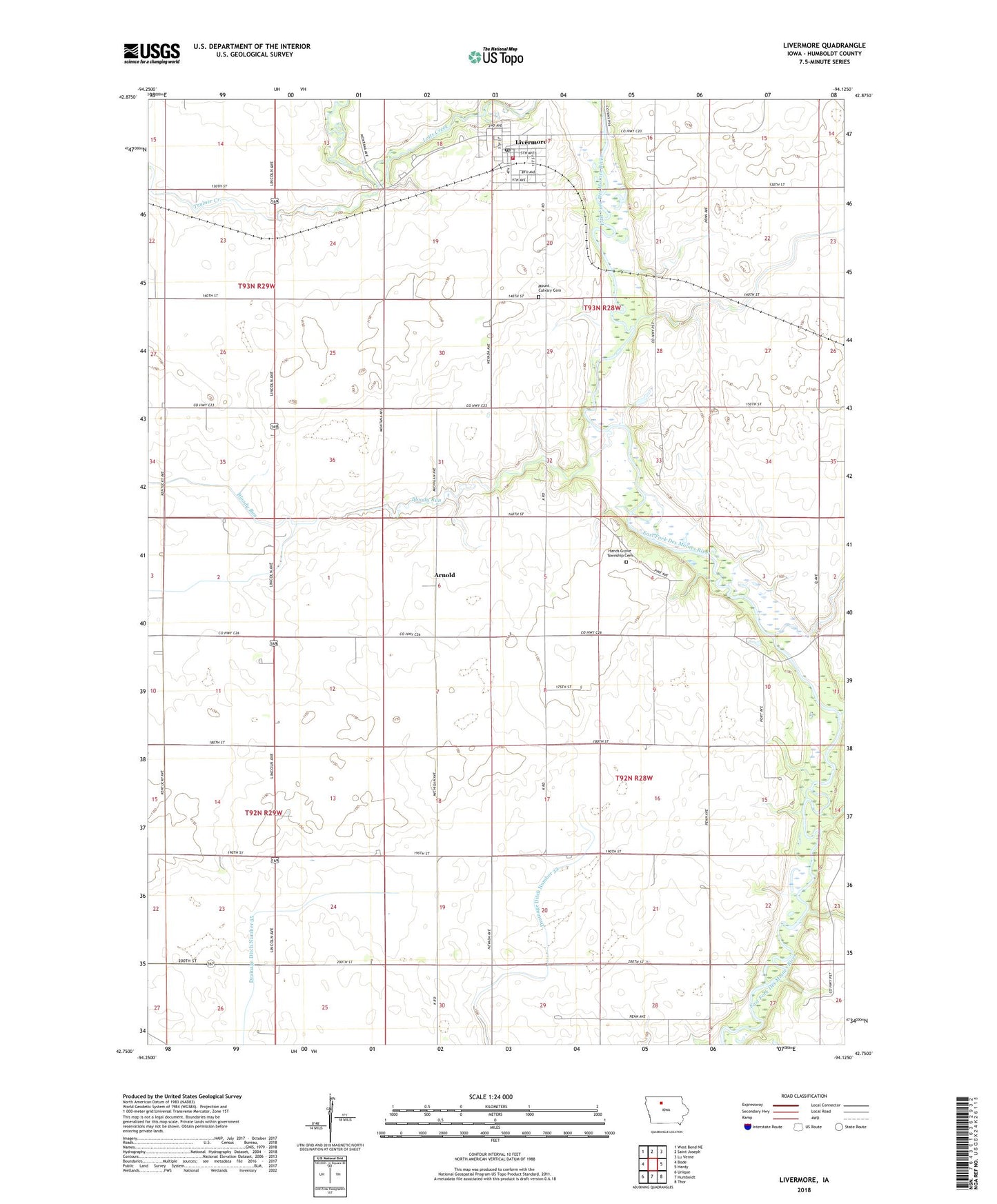
2022 topographic map quadrangle Livermore in the state of Iowa. Scale: 1:24000. Based on the newly updated USGS 7.5' US Topo map series, this map is in the following counties: Humboldt. The map contains contour data, water features, and other items you are used to seeing on USGS maps, but also has updated roads and other features. This is the next generation of topographic maps. Printed on high-quality waterproof paper with UV fade-resistant inks.
Quads adjacent to this one:
West: Bode
Northwest: West Bend NE
North: Saint Joseph
Northeast: Lu Verne
East: Hardy
Southeast: Thor
South: Humboldt
Southwest: Unique
This map covers the same area as the classic USGS quad with code o42094g2.
Contains the following named places: Arnold, Arnold Post Office, Bloody Run, City of Livermore, Drainage Ditch Number 29, Drainage Ditch Number 33, Drainage Ditch Number 35, Gold Eagle Co-op Elevator, Hands Grove Township Cemetery, Humboldt County, Immanuel Lutheran Church, Livermore, Livermore City Hall, Livermore Elementary School, Livermore Fire Department, Livermore Post Office, Livermore Public Library, Lotts Creek Post Office, Lotts Park, Mount Calvary Cemetery, Randolph Post Office, Sacred Heart Catholic Church, Township of Grove, Township of Humboldt, Trulner Creek, United Methodist Church, Von Post Office, ZIP Code: 50558