MyTopo
Bode Iowa US Topo Map
Couldn't load pickup availability
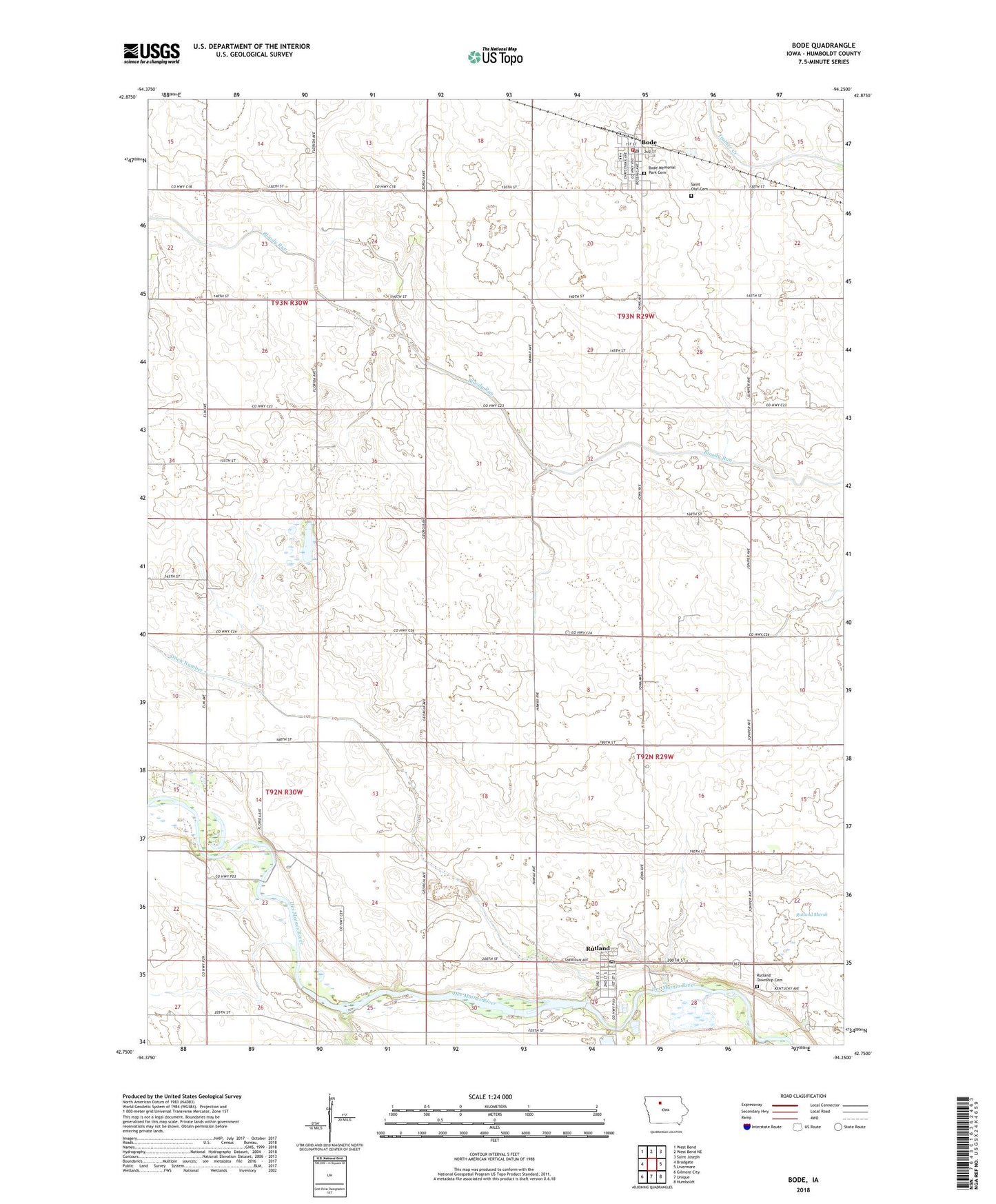
2022 topographic map quadrangle Bode in the state of Iowa. Scale: 1:24000. Based on the newly updated USGS 7.5' US Topo map series, this map is in the following counties: Humboldt. The map contains contour data, water features, and other items you are used to seeing on USGS maps, but also has updated roads and other features. This is the next generation of topographic maps. Printed on high-quality waterproof paper with UV fade-resistant inks.
Quads adjacent to this one:
West: Bradgate
Northwest: West Bend
North: West Bend NE
Northeast: Saint Joseph
East: Livermore
Southeast: Humboldt
South: Unique
Southwest: Gilmore City
This map covers the same area as the classic USGS quad with code o42094g3.
Contains the following named places: Bode, Bode City Hall, Bode City Library, Bode Cooperative Elevator, Bode Fire Department, Bode Post Office, City of Bode, City of Rutland, Ditch Number 7, Faith United Methodist Church, Nora Post Office, Ottosen Marsh State Game Management Area, Pleasant View Post Office, Pro Cooperative Elevator, Rutland, Rutland Marsh, Rutland Mill Dam, Rutland Post Office, Rutland Town Hall, Rutland Township Cemetery, Saint Olaf Cemetery, Saint Olaf Churchyard Cemetery, Saint Olaf Lutheran Church, Township of Delana, Township of Rutland, Trimark Physicians Group Building, Trinity Church, Trinity Lutheran Church, Twin River Valley High School, Twin Rivers Elementary School, ZIP Code: 50582