MyTopo
Saint Joseph Iowa US Topo Map
Couldn't load pickup availability
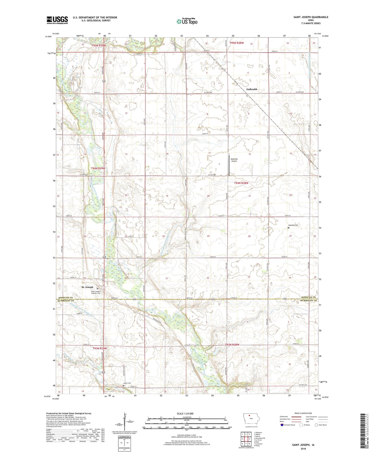
2022 topographic map quadrangle Saint Joseph in the state of Iowa. Scale: 1:24000. Based on the newly updated USGS 7.5' US Topo map series, this map is in the following counties: Kossuth, Humboldt. The map contains contour data, water features, and other items you are used to seeing on USGS maps, but also has updated roads and other features. This is the next generation of topographic maps. Printed on high-quality waterproof paper with UV fade-resistant inks.
Quads adjacent to this one:
West: West Bend NE
Northwest: Hobarton
North: Algona
Northeast: Sexton
East: Lu Verne
Southeast: Hardy
South: Livermore
Southwest: Bode
This map covers the same area as the classic USGS quad with code o42094h2.
Contains the following named places: Byron Post Office, Damman Cemetery, Devine Wildlife Area, Drainage Ditch Number 1, Drainage Ditch Number 116, Drainage Ditch Number 182, Drainage Ditch Number 8, Eber, Eber Post Office, Fourmile Creek, Galbraith, Galbraith Post Office, Kohlhaas Airport, Lotts Creek, Saint Joseph, Saint Joseph Catholic Church, Saint Joseph Census Designated Place, Saint Joseph Posot Office, Saint Joseph's Catholic Cemetery, Spring Valley Golf Course, Sumner, Township of Sherman, Union Cemetery