MyTopo
Logan Iowa US Topo Map
Couldn't load pickup availability
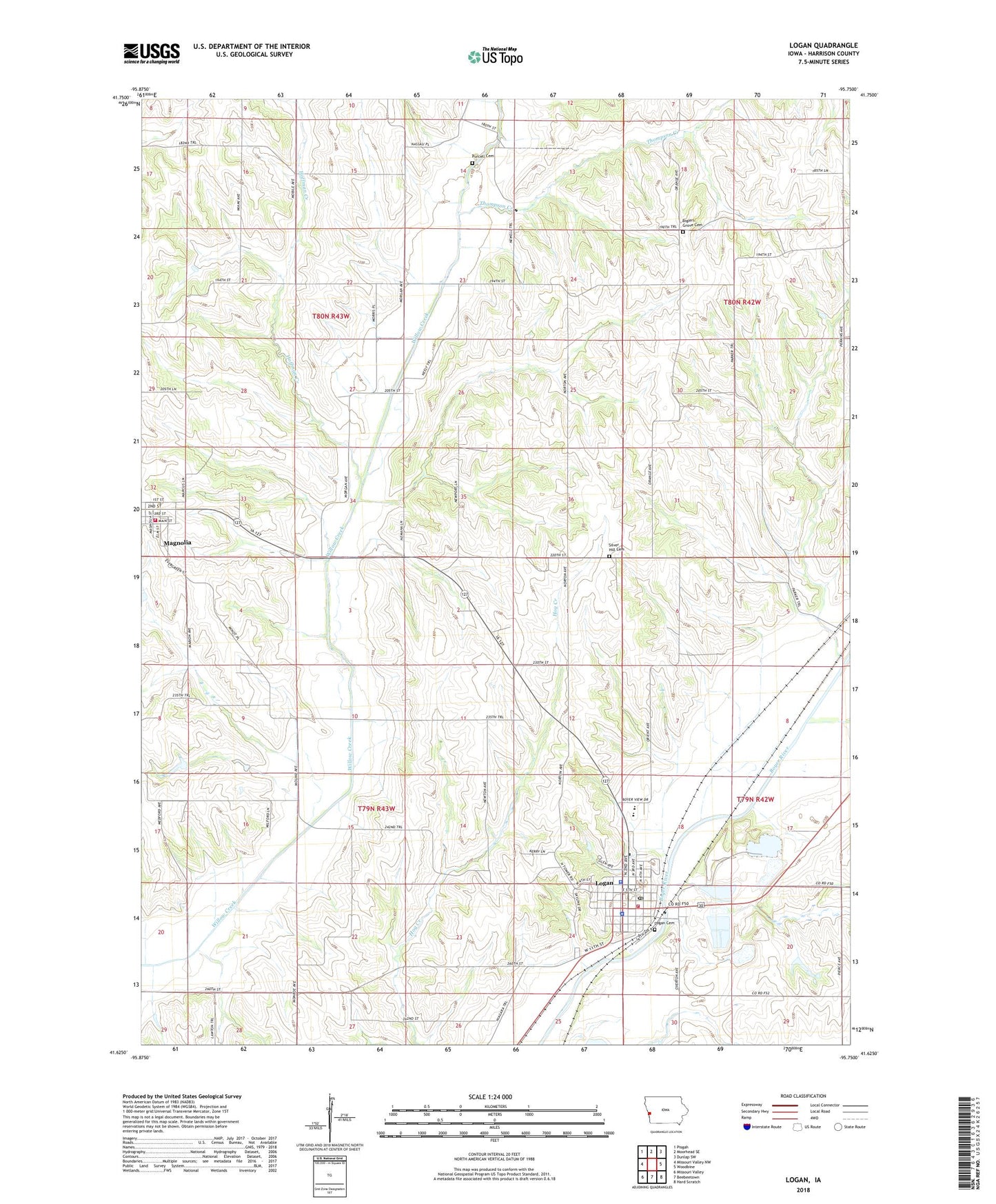
2022 topographic map quadrangle Logan in the state of Iowa. Scale: 1:24000. Based on the newly updated USGS 7.5' US Topo map series, this map is in the following counties: Harrison. The map contains contour data, water features, and other items you are used to seeing on USGS maps, but also has updated roads and other features. This is the next generation of topographic maps. Printed on high-quality waterproof paper with UV fade-resistant inks.
Quads adjacent to this one:
West: Missouri Valley NW
Northwest: Pisgah
North: Moorhead SE
Northeast: Dunlap SW
East: Woodbine
Southeast: Hard Scratch
South: Beebeetown
Southwest: Missouri Valley
This map covers the same area as the classic USGS quad with code o41095f7.
Contains the following named places: Alegent Health Logan Clinic, Biglers Grove Cemetery, Christian Church, City of Logan, City of Magnolia, Harrison County, Harrison County Courthouse, Harrison County Sheriff's Office, Hoffman Creek, Immanuel Lutheran Church, Landmark Baptist Mission, Logan, Logan - Magnolia Elementary School, Logan - Magnolia Junior - Senior High School, Logan Cemetery, Logan City Hall, Logan City Police Department, Logan Community Center, Logan Family Dentistry Center, Logan Post Office, Logan Public Library, Logan Quarry, Logan Volunteer Fire and Rescue Association, Magnolia Volunteer Fire and Rescue Association, Museum of Religious Arts, Purcell Cemetery, Reorganized Church of Jesus Christ of Latter Day Saints, Saint Annes Parish, Silver Hill Cemetery, The Church of Jesus Christ of Latter Day Saints, Thompson Creek, Township of Calhoun, Township of Magnolia, United Methodist Church, Westmont Care Center, Zion Lutheran Church, ZIP Codes: 51546, 51550