MyTopo
Tingley NE Iowa US Topo Map
Couldn't load pickup availability
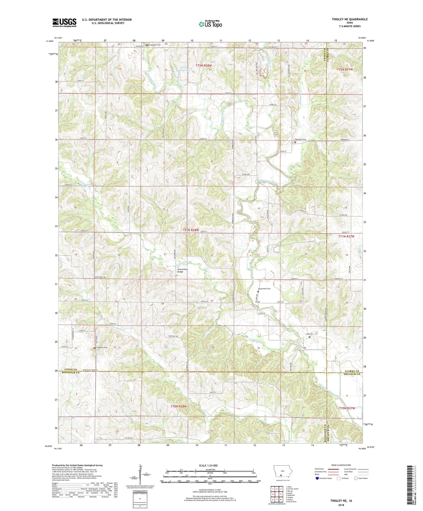
2022 topographic map quadrangle Tingley NE in the state of Iowa. Scale: 1:24000. Based on the newly updated USGS 7.5' US Topo map series, this map is in the following counties: Union, Ringgold, Clarke, Decatur. The map contains contour data, water features, and other items you are used to seeing on USGS maps, but also has updated roads and other features. This is the next generation of topographic maps. Printed on high-quality waterproof paper with UV fade-resistant inks.
Quads adjacent to this one:
West: Arispe
Northwest: Afton
North: Lorimor South
Northeast: Murray
East: Hopeville
Southeast: Grand River
South: Ellston
Southwest: Tingley
This map covers the same area as the classic USGS quad with code o40094h1.
Contains the following named places: Cornwall Cemetery, Fourmile Creek, Grand River Bridge, Homewood Cemetery, Leas Cemetery, Oak Hill Church, Olinger Cemetery, Olio Post Office, Otterbein Cemetery, Pleasant Valley Church, Sevenmile Creek, Silver Street, Silver Street Post Office, Spring Valley Lake, Thayer Quarry, Township of Pleasant, Twelvemile Creek, ZIP Code: 50254