MyTopo
Luton Iowa US Topo Map
Couldn't load pickup availability
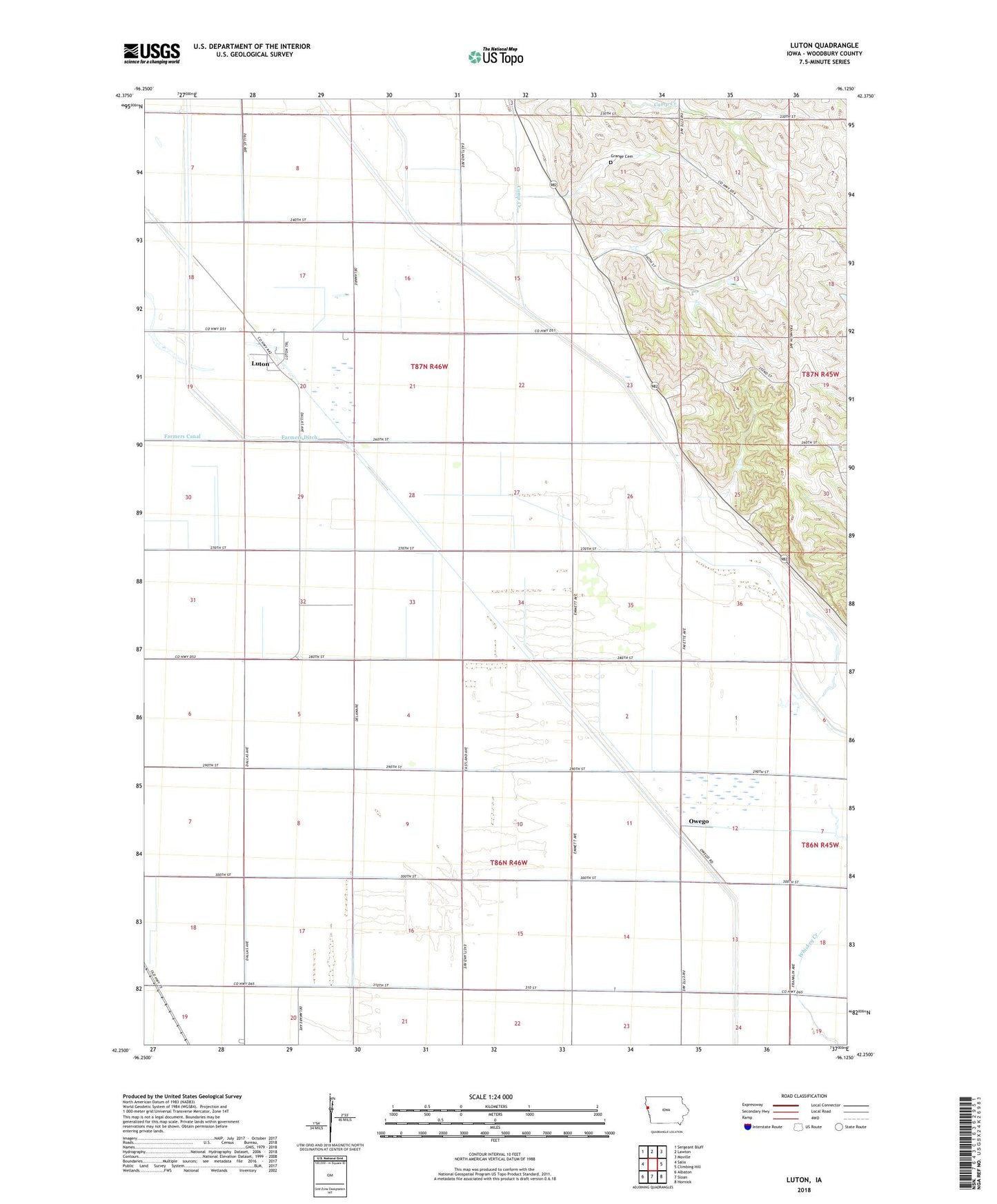
2022 topographic map quadrangle Luton in the state of Iowa. Scale: 1:24000. Based on the newly updated USGS 7.5' US Topo map series, this map is in the following counties: Woodbury. The map contains contour data, water features, and other items you are used to seeing on USGS maps, but also has updated roads and other features. This is the next generation of topographic maps. Printed on high-quality waterproof paper with UV fade-resistant inks.
Quads adjacent to this one:
West: Salix
Northwest: Sergeant Bluff
North: Lawton
Northeast: Moville
East: Climbing Hill
Southeast: Hornick
South: Sloan
Southwest: Albaton
This map covers the same area as the classic USGS quad with code o42096c2.
Contains the following named places: Camp Creek, Farmers Ditch, Grange Cemetery, Luton, Luton Post Office, Odd Post Office, Owego, Owego Post Office, Snyders Grove, Township of Grange, Township of Sloan