MyTopo
Sloan Iowa US Topo Map
Couldn't load pickup availability
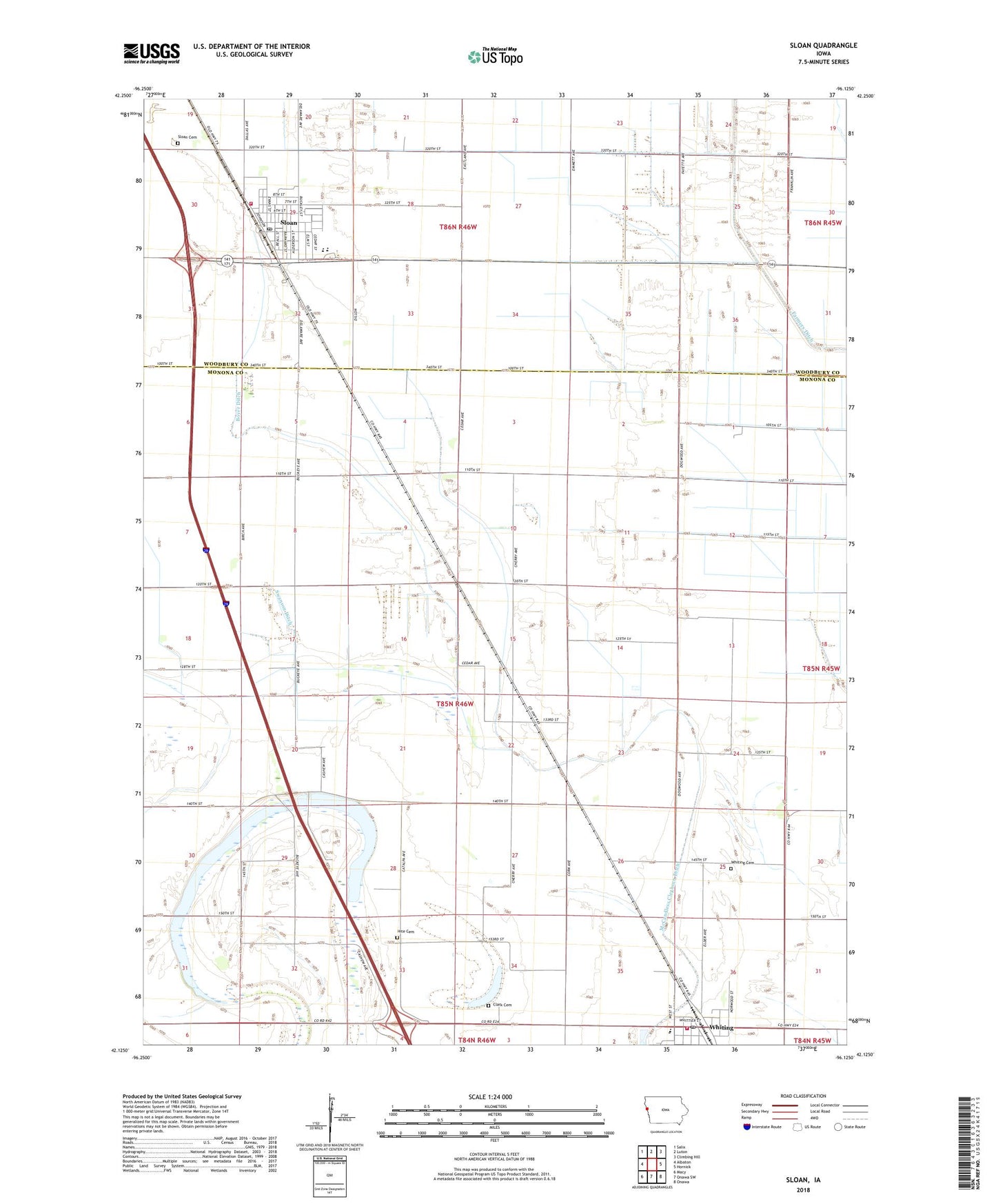
2022 topographic map quadrangle Sloan in the state of Iowa. Scale: 1:24000. Based on the newly updated USGS 7.5' US Topo map series, this map is in the following counties: Monona, Woodbury. The map contains contour data, water features, and other items you are used to seeing on USGS maps, but also has updated roads and other features. This is the next generation of topographic maps. Printed on high-quality waterproof paper with UV fade-resistant inks.
Quads adjacent to this one:
West: Albaton
Northwest: Salix
North: Luton
Northeast: Climbing Hill
East: Hornick
Southeast: Onawa
South: Onawa SW
Southwest: Macy
This map covers the same area as the classic USGS quad with code o42096b2.
Contains the following named places: Badger Lake, Badger Lake State Wildlife Management Area, Boyer Ditch, Burgess Family Clinic, Church of Christ, City of Sloan, City of Whiting, Clark Cemetery, Congregational Church, Covenant Church, First Christian Church, Hite Cemetery, Irish Lake, Kingdom Hall of Jehovahs Witnesses, Lossing Post Office, Pleasant View Care Center, Skunk Lake, Sloan, Sloan Cemetery, Sloan City Hall, Sloan City Police Department, Sloan Family Dentistry Center, Sloan Fire and Rescue, Sloan Golf Course, Sloan Post Office, Sloan Public Library, Swanson Ditch, Township of Lake, United Congregational Church, Westwood Elementary School, Westwood Secondary School, Whiting, Whiting Cemetery, Whiting Elementary School, Whiting Post Office, Whiting Public Library, Whiting Secondary School, Whiting Volunteer Fire Department, ZIP Code: 51063