MyTopo
Salix Iowa US Topo Map
Couldn't load pickup availability
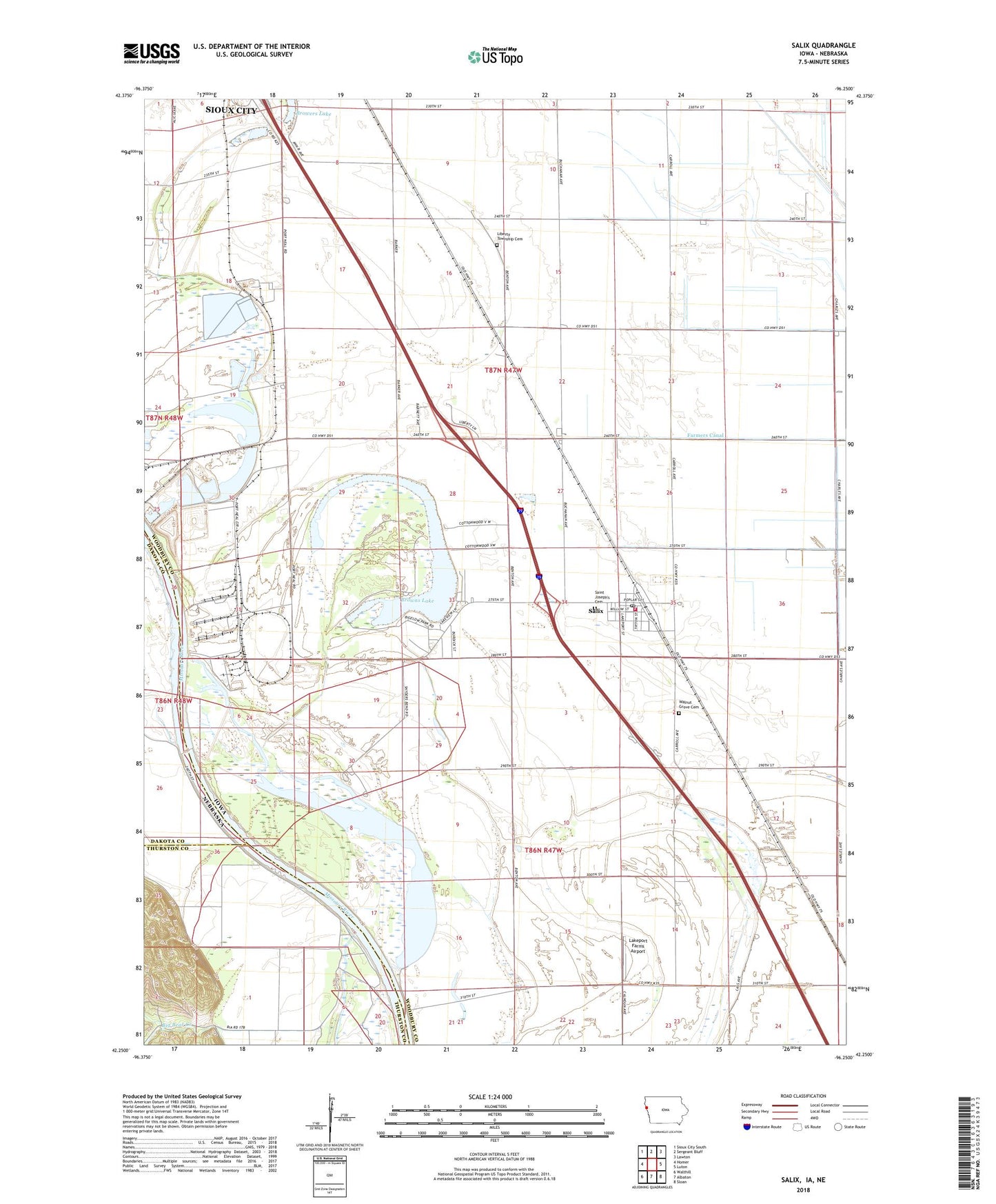
2022 topographic map quadrangle Salix in the states of Iowa, Nebraska. Scale: 1:24000. Based on the newly updated USGS 7.5' US Topo map series, this map is in the following counties: Woodbury, Thurston, Dakota. The map contains contour data, water features, and other items you are used to seeing on USGS maps, but also has updated roads and other features. This is the next generation of topographic maps. Printed on high-quality waterproof paper with UV fade-resistant inks.
Quads adjacent to this one:
West: Homer
Northwest: Sioux City South
North: Sergeant Bluff
Northeast: Lawton
East: Luton
Southeast: Sloan
South: Albaton
Southwest: Walthill
Contains the following named places: Big Bear Creek, Browers Lake, Browns Lake, Browns Lake - Bigelow Park, Browns Lake/IPS Wildlife Management Area, City of Salix, Dale G Bell Memorial Arboretum, Farmers Canal, Farmers Co-op Elevator, Flanders, Lakeport Area, Lakeport Farms Airport, Lakeport Post Office, Liberty Township Cemetery, Linndale Post Office, Saint Joseph School, Saint Joseph's Catholic Church, Saint Josephs Cemetery, Salix, Salix City Hall, Salix Community United Methodist Church, Salix Fire and Rescue, Salix Police Department, Salix Post Office, Snyder Bend Park, Snyder-Winnebago Bends Area, Township of Lakeport, Township of Liberty, Walnut Grove Cemetery, ZIP Code: 51052