MyTopo
Mackey Iowa US Topo Map
Couldn't load pickup availability
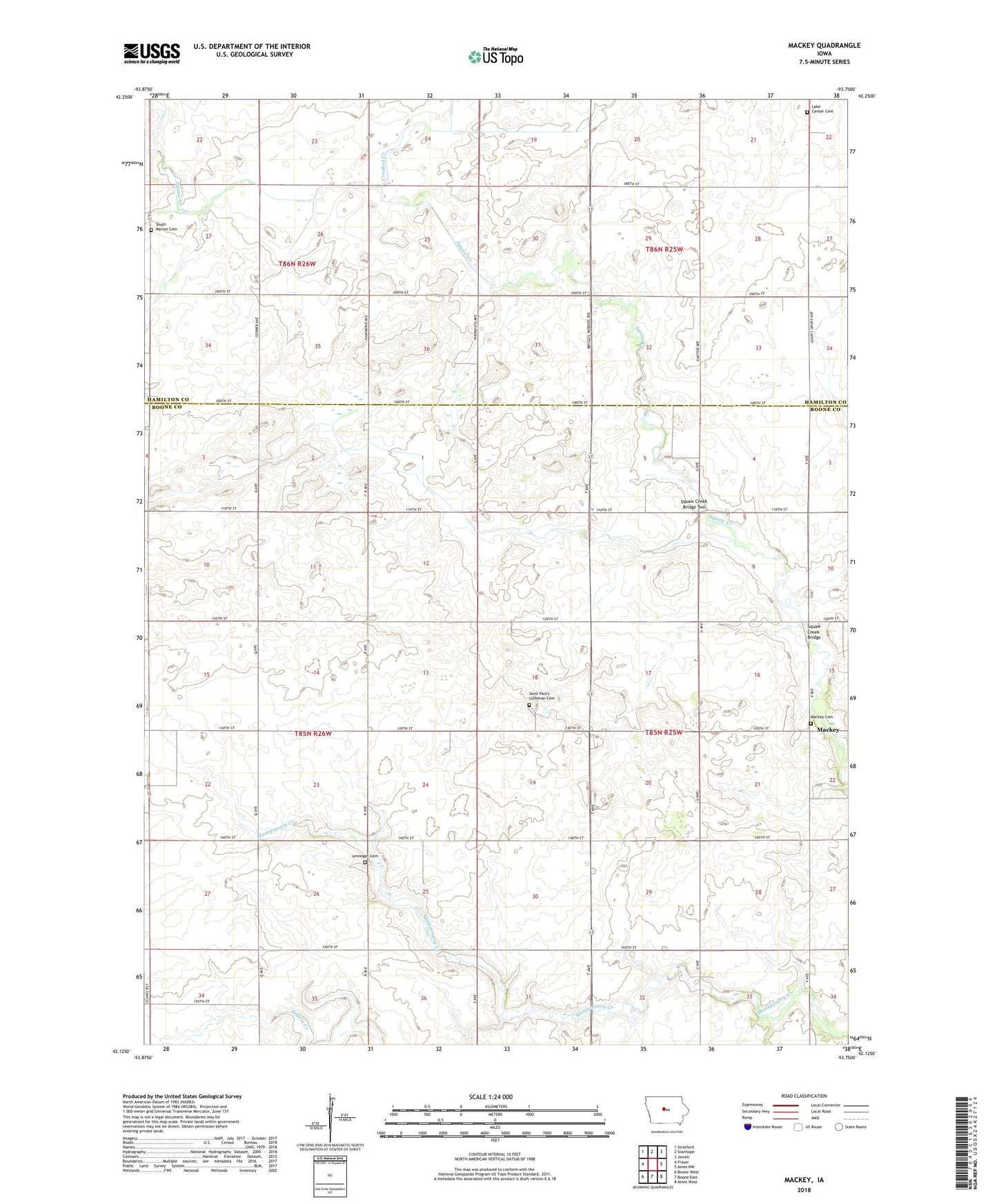
2022 topographic map quadrangle Mackey in the state of Iowa. Scale: 1:24000. Based on the newly updated USGS 7.5' US Topo map series, this map is in the following counties: Boone, Hamilton. The map contains contour data, water features, and other items you are used to seeing on USGS maps, but also has updated roads and other features. This is the next generation of topographic maps. Printed on high-quality waterproof paper with UV fade-resistant inks.
Quads adjacent to this one:
West: Fraser
Northwest: Stratford
North: Stanhope
Northeast: Jewell
East: Ames NW
Southeast: Ames West
South: Boone East
Southwest: Boone West
This map covers the same area as the classic USGS quad with code o42093b7.
Contains the following named places: Crooked Creek, Griffen, Griffin Post Office, Lake Center, Lake Center Cemetery, Leininger Cemetery, Mackey, Mackey Cemetery, Mackey Post Office, Mackey School, Saint Marys Church, Saint Paul School, Saint Pauls Evangelical Lutheran Cemetery, South Marion Cemetery, Squaw Creek Bridge, Squaw Creek Bridge Two, Township of Harrison