MyTopo
Stanhope Iowa US Topo Map
Couldn't load pickup availability
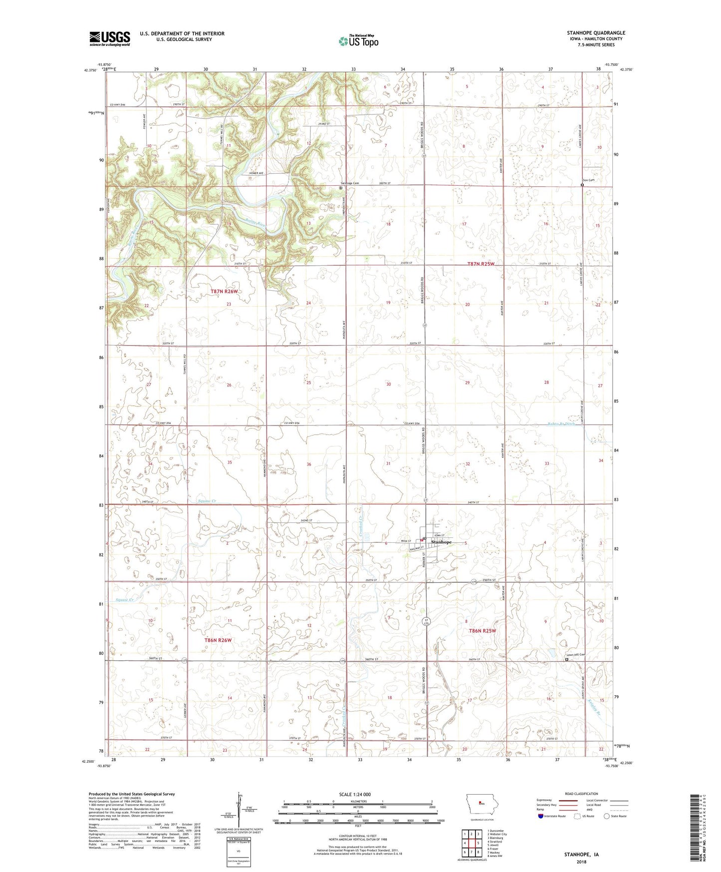
2022 topographic map quadrangle Stanhope in the state of Iowa. Scale: 1:24000. Based on the newly updated USGS 7.5' US Topo map series, this map is in the following counties: Hamilton. The map contains contour data, water features, and other items you are used to seeing on USGS maps, but also has updated roads and other features. This is the next generation of topographic maps. Printed on high-quality waterproof paper with UV fade-resistant inks.
Quads adjacent to this one:
West: Stratford
Northwest: Duncombe
North: Webster City
Northeast: Blairsburg
East: Jewell
Southeast: Ames NW
South: Mackey
Southwest: Fraser
This map covers the same area as the classic USGS quad with code o42093c7.
Contains the following named places: Central Iowa Cooperative Elevator, City of Stanhope, Country Relics Village, Lake Center, Lake Center Post Office, Lawn Hill Cemetery, Our Saviour's Lutheran Church, Saratoga Cemetery, Stanhope, Stanhope Fire and Rescue, Stanhope Library, Stanhope Parish Church, Stanhope Police Department, Stanhope Post Office, Township of Clear Lake, Township of Hamilton, Township of Marion, Township of Webster, Tunnel, Tunnel Mill Area, Tunnel Post Office, Zion Cemetery, ZIP Code: 50246