MyTopo
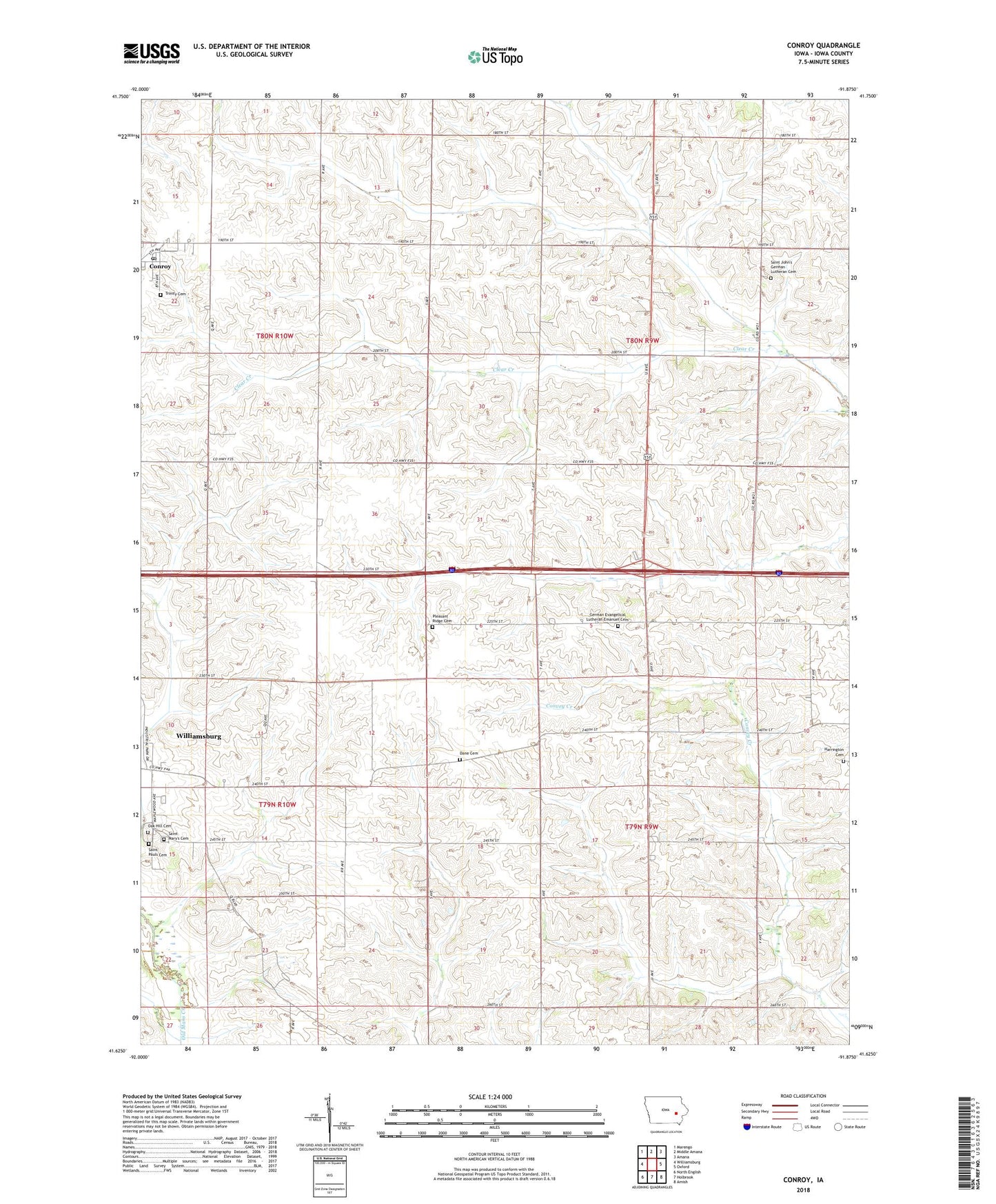
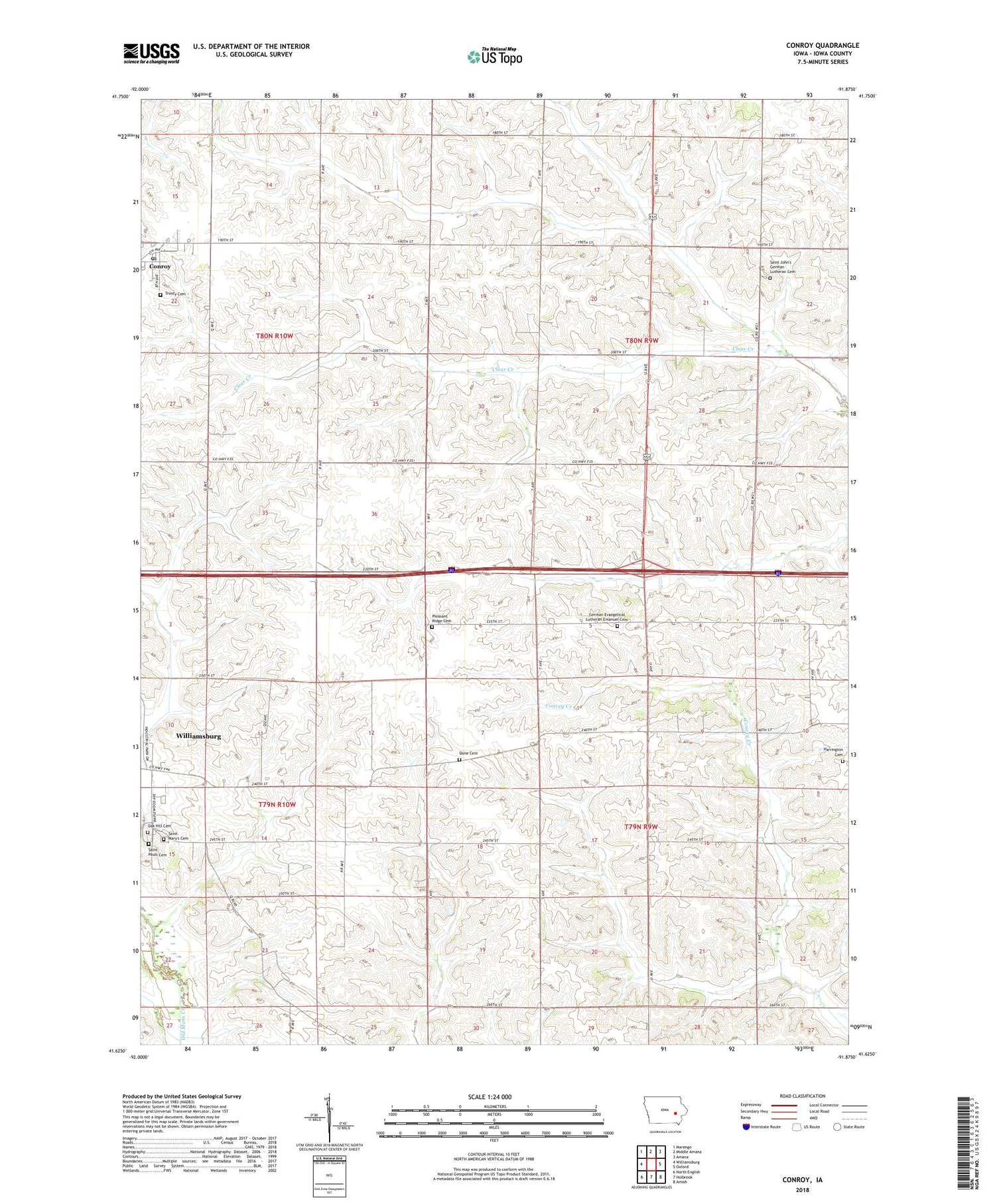
Conroy Iowa US Topo Map
Couldn't load pickup availability
2022 topographic map quadrangle Conroy in the state of Iowa. Scale: 1:24000. Based on the newly updated USGS 7.5' US Topo map series, this map is in the following counties: Iowa. The map contains contour data, water features, and other items you are used to seeing on USGS maps, but also has updated roads and other features. This is the next generation of topographic maps. Printed on high-quality waterproof paper with UV fade-resistant inks.
Quads adjacent to this one:
West: Williamsburg
Northwest: Marengo
North: Middle Amana
Northeast: Amana
East: Oxford
Southeast: Amish
South: Holbrook
Southwest: North English
This map covers the same area as the classic USGS quad with code o41091f8.
Contains the following named places: Amana Welcome Center, Conroy, Conroy Census Designated Place, Conroy Post Office, Dane Cemetery, East York Cemetery, First Lutheran Church, Fox Post Office, Immanuel Church, Immanuel Lutheran Cemetery, KRNA-FM (Iowa City), Oak Hill Cemetery, Old Scotch Cemetery, Pleasant Ridge Cemetery, Saint John Lutheran Cemetery, Saint Johns Church, Saint Marys Cemetery, Saint Paul Lutheran Cemetery, Township of Iowa, Township of York, Trinity Lutheran Cemetery, Trinity Lutheran Church, Weiss Airport, York Center, York Center Post Office, ZIP Codes: 52220, 52236, 52334