MyTopo
Marion Iowa US Topo Map
Couldn't load pickup availability
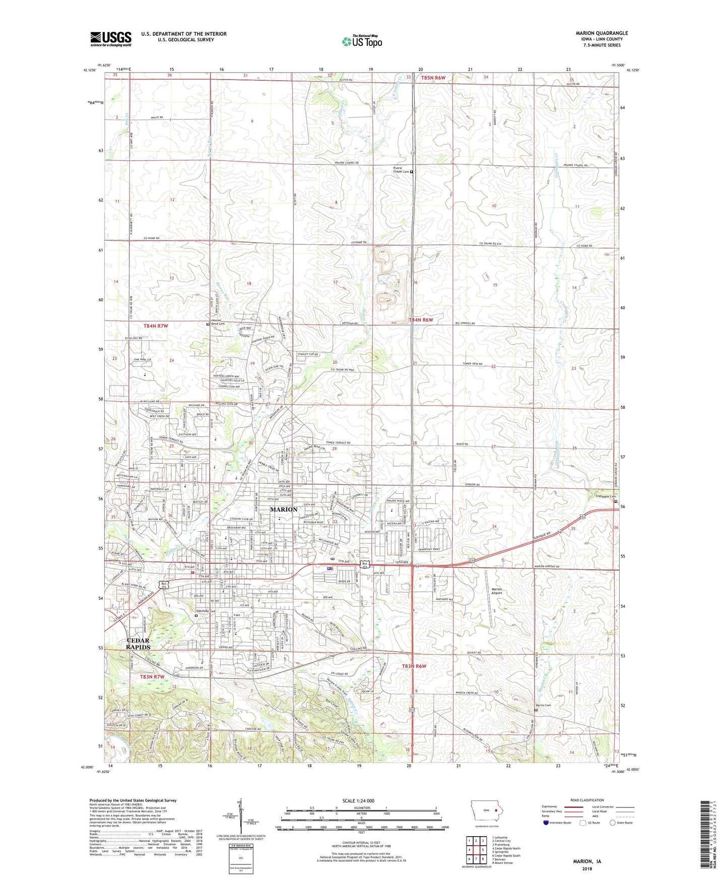
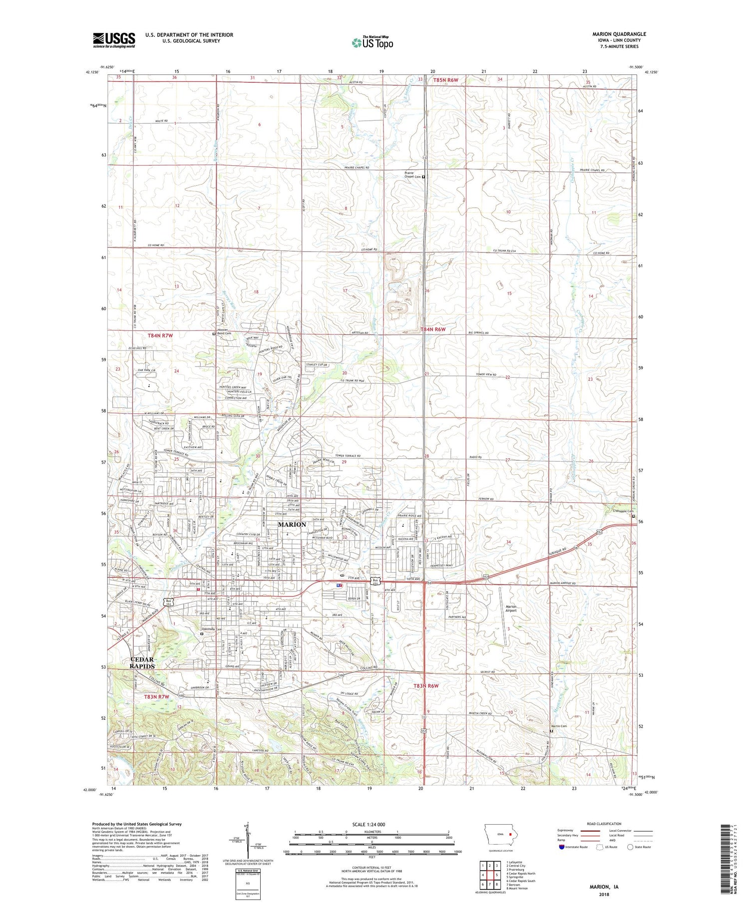
2023 topographic map quadrangle Marion in the state of Iowa. Scale: 1:24000. Based on the newly updated USGS 7.5' US Topo map series, this map is in the following counties: Linn. The map contains contour data, water features, and other items you are used to seeing on USGS maps, but also has updated roads and other features. This is the next generation of topographic maps. Printed on high-quality waterproof paper with UV fade-resistant inks.
Quads adjacent to this one:
West: Cedar Rapids North
Northwest: Lafayette
North: Central City
Northeast: Prairieburg
East: Springville
Southeast: Mount Vernon
South: Bertram
Southwest: Cedar Rapids South
This map covers the same area as the classic USGS quad with code o42091a5.
Contains the following named places: Antioch Christian Church, Area Ambulance Service Marion, Ascension Church, Berrys Run, Boyson Park, Cedar Rapids Country Club, Christ Community Church, Church of Christ, Church of God Seventh Day, City of Marion, Crabapple Cemetery, Crestview Acres, Daniels and the Old Dubuque Road Historical Marker, Donnelly Park, Dry Creek, Dry Creek Post Office, Eagle Ridge Park, East End Shopping Center, East Indian Creek, Elza Park, Emerson Elementary School, Excelsior Middle School, Faith United Methodist Church, Family Foot Care Center, First Baptist Church of Marion, First Presbyterian Church, First United Methodist Church, Francis Marion Intermediate School, Gospel Light Baptist Church, Grace Baptist Academy, Granger House - Marion Historical Museum, Hanna Park, Hoosier Bend Cemetery, Hunters Ridge Golf Course, Indian Creek Country Club, Indian Creek Elementary School, Irving School, Kirkwood Community College, Legion Park, Lincoln School, Lininger Park, Linn - Mar High School, Linn County, Linn County Home, Linn Grove Elementary School, Longfellow School, Marion, Marion Airport, Marion Carnegie Library, Marion Christian Church, Marion City Hall, Marion Family Practice Center, Marion Fire Department Station 1, Marion Fire Department Station 2, Marion Football Field, Marion Free Methodist Church, Marion Gospel Hall, Marion Heights Shopping Center, Marion High School, Marion Mobile Home Park, Marion Police Department, Marion Post Office, Marion United Pentecostal Church, Martin Creek Cemetery, Mercy Care Center at Marion, Novak Elementary School, Oak Ridge Middle School, Oakshade Cemetery, Open Door Christian Church, Prairie Chapel Cemetery, Residential Care Facility, Resurrection Lutheran Church, Robbins Lake, Rural, Rural Post Office, Saint Joseph Catholic School, Saint Josephs Church, Saint Pauls Lutheran Church, South Landfill Park, Squaw Creek Baptist Church, Squaw Creek Municipal Golf Course, Squaw Creek Regional Park, Squaw Creek Village, Starry Elementary School, Starry Park, Tauher Park, The Church of Jesus Christ of Latter Day Saints, Thomas Park, Township of Marion, Trinity Bible Church, Trinity Church of the Nazarene, Vernon Middle School, Victory Christian Church, Wilkins Elementary School, Willow Gardens Care Center, Willow Park, Willowood Creek, Willowood Park, Winslow House Care Center, WMT-AM (Cedar Rapids), ZIP Code: 52302