MyTopo
Prairieburg Iowa US Topo Map
Couldn't load pickup availability
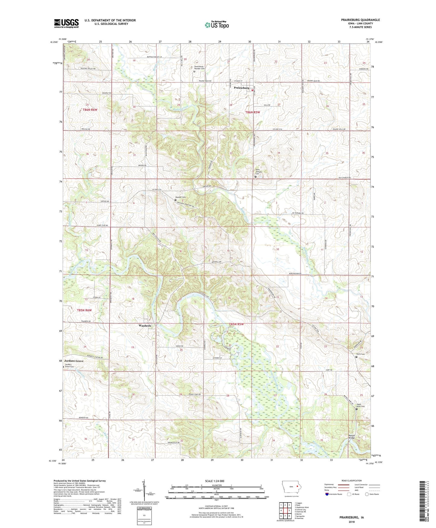
2022 topographic map quadrangle Prairieburg in the state of Iowa. Scale: 1:24000. Based on the newly updated USGS 7.5' US Topo map series, this map is in the following counties: Linn. The map contains contour data, water features, and other items you are used to seeing on USGS maps, but also has updated roads and other features. This is the next generation of topographic maps. Printed on high-quality waterproof paper with UV fade-resistant inks.
Quads adjacent to this one:
West: Central City
Northwest: Coggon
North: Ryan
Northeast: Hopkinton West
East: Anamosa NE
Southeast: Anamosa
South: Springville
Southwest: Marion
This map covers the same area as the classic USGS quad with code o42091b4.
Contains the following named places: Boulder Cemetery, Boulder Creek, Camp Wakomda, Camp Waubeek, City of Prairieburg, Cousins Post Office, Flemingville Post Office, Harts Cemetery, Hazel Knoll Cemetery, Heatons Creek, Jay G Sigmund Park, Jordans Grove, Matsell Bridge, Matsell Bridge Public Access, Necot, Necot Post Office, Paris, Prairieburg, Prairieburg - Boulder Cemetery, Prairieburg Fire Department, Prairieburg Post Office, Saint Joseph Church, Saint Josephs Cemetery, Township of Buffalo, Waubeek, Waubeek Post Office, ZIP Code: 52219