MyTopo
Springville Iowa US Topo Map
Couldn't load pickup availability
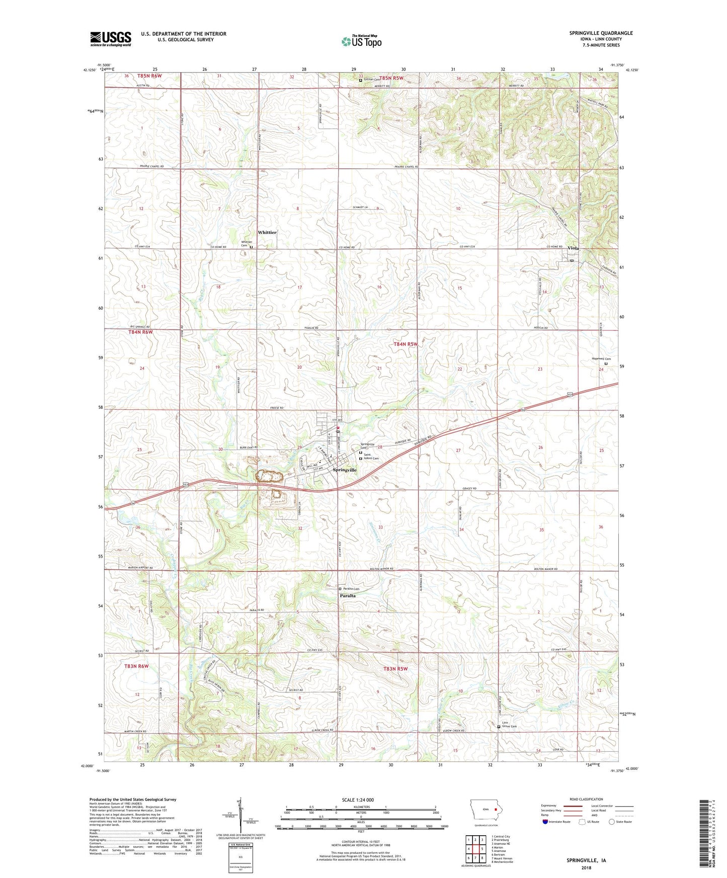
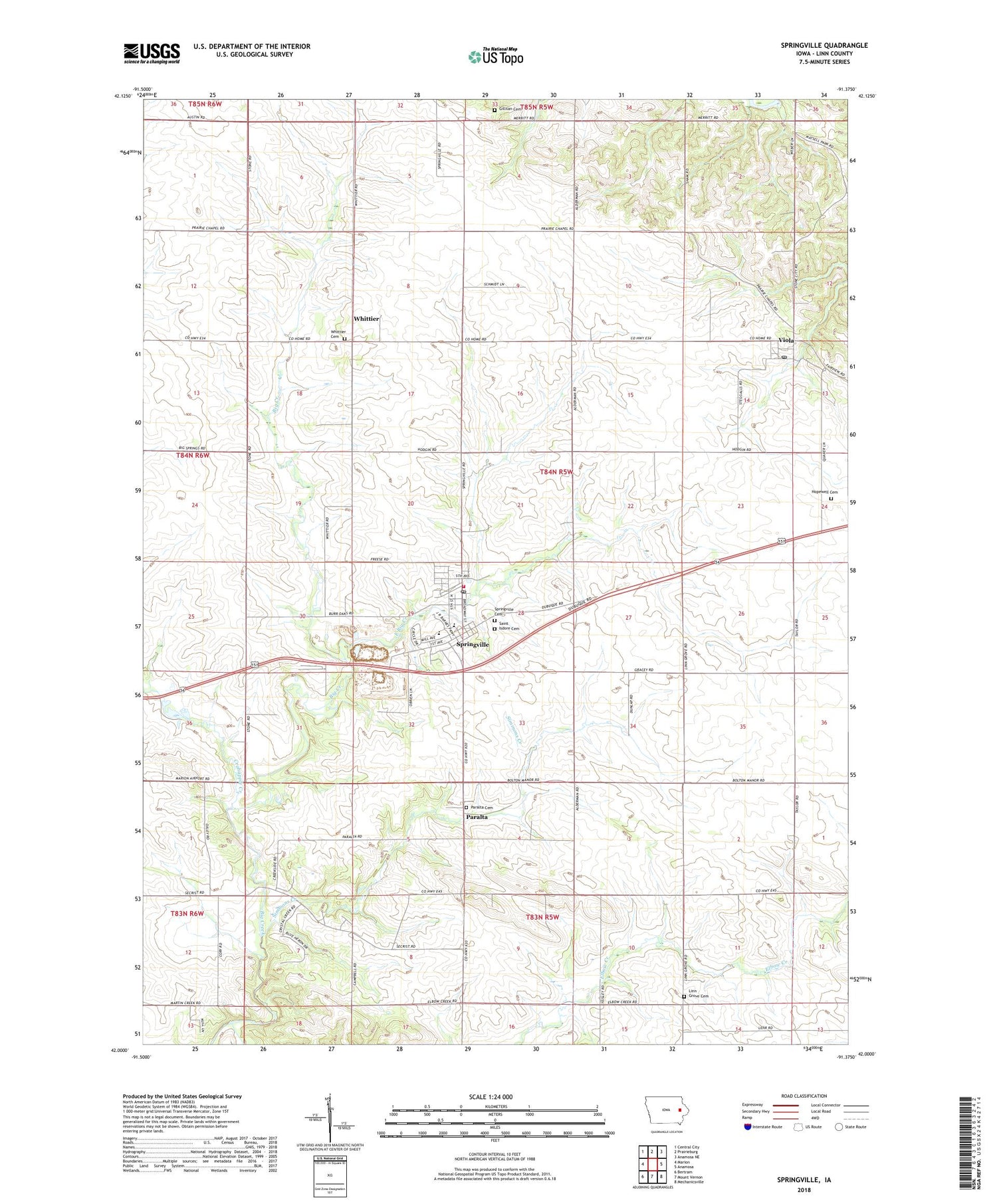
2022 topographic map quadrangle Springville in the state of Iowa. Scale: 1:24000. Based on the newly updated USGS 7.5' US Topo map series, this map is in the following counties: Linn. The map contains contour data, water features, and other items you are used to seeing on USGS maps, but also has updated roads and other features. This is the next generation of topographic maps. Printed on high-quality waterproof paper with UV fade-resistant inks.
Quads adjacent to this one:
West: Marion
Northwest: Central City
North: Prairieburg
Northeast: Anamosa NE
East: Anamosa
Southeast: Mechanicsville
South: Mount Vernon
Southwest: Bertram
This map covers the same area as the classic USGS quad with code o42091a4.
Contains the following named places: Bowser Quarry, Carlton Mobile Home Court, City of Springville, Crab Apple, Crabapple Creek, Crabapple Post Office, East Big Creek, Elbow Creek, Faith Christian Fellowship, Gillilan Cemetery, Hopewell Cemetery, Linn Grove Cemetery, Linn Grove Church, Nathan Brown Historical Marker, Paralta, Paralta Cemetery, Paralta Post Office, Saint Isidore Catholic Church, Saint Isidore Cemetery, Simmons Creek, Springville, Springville Cemetery, Springville City Hall, Springville Elementary School, Springville Fire Department, Springville Memorial Library, Springville Middle / High School, Springville Post Office, Springville Presbyterian Church, Township of Brown, United Methodist Church, Viola, Viola Post Office, Whittier, Whittier Cemetery, Whittier Friends Meeting, Whittier Post Office, ZIP Code: 52336