MyTopo
Scotch Ridge Iowa US Topo Map
Couldn't load pickup availability
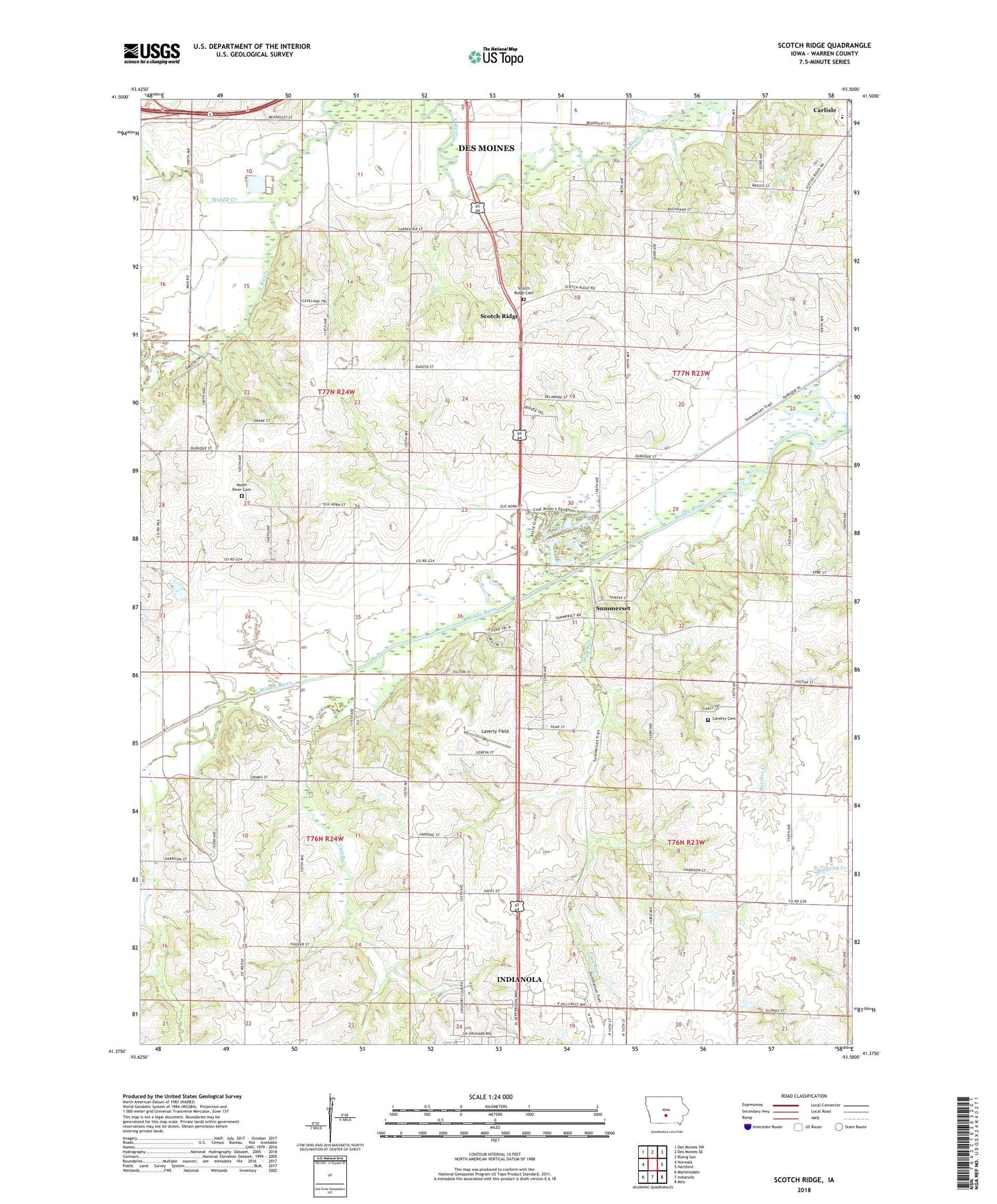
2022 topographic map quadrangle Scotch Ridge in the state of Iowa. Scale: 1:24000. Based on the newly updated USGS 7.5' US Topo map series, this map is in the following counties: Warren. The map contains contour data, water features, and other items you are used to seeing on USGS maps, but also has updated roads and other features. This is the next generation of topographic maps. Printed on high-quality waterproof paper with UV fade-resistant inks.
Quads adjacent to this one:
West: Norwalk
Northwest: Des Moines SW
North: Des Moines SE
Northeast: Rising Sun
East: Hartford
Southeast: Milo
South: Indianola
Southwest: Martensdale
This map covers the same area as the classic USGS quad with code o41093d5.
Contains the following named places: Banner Mine State Wildlife Management Area, Carlisle Middle School, Cavitt Creek, Farmers Chapel, Indianola Country Club, Indianola Friends Church, Indianola Water Pollution Control Plant, Laverty Field, Loerke-Fox Run Aerodrome, Lundy Acres, National Balloon Museum, North River Cemetery, North River Church, Peck Cemetery, Plug Run, Scotch Ridge, Scotch Ridge Cemetery, Scotch Ridge United Presbyterian Church, Summerset, Summerset Junction, Summerset Post Office, Township of Allen, Township of Greenfield, Tuinstra Airfield, Wilson Woods