MyTopo
Anson Missouri US Topo Map
Couldn't load pickup availability
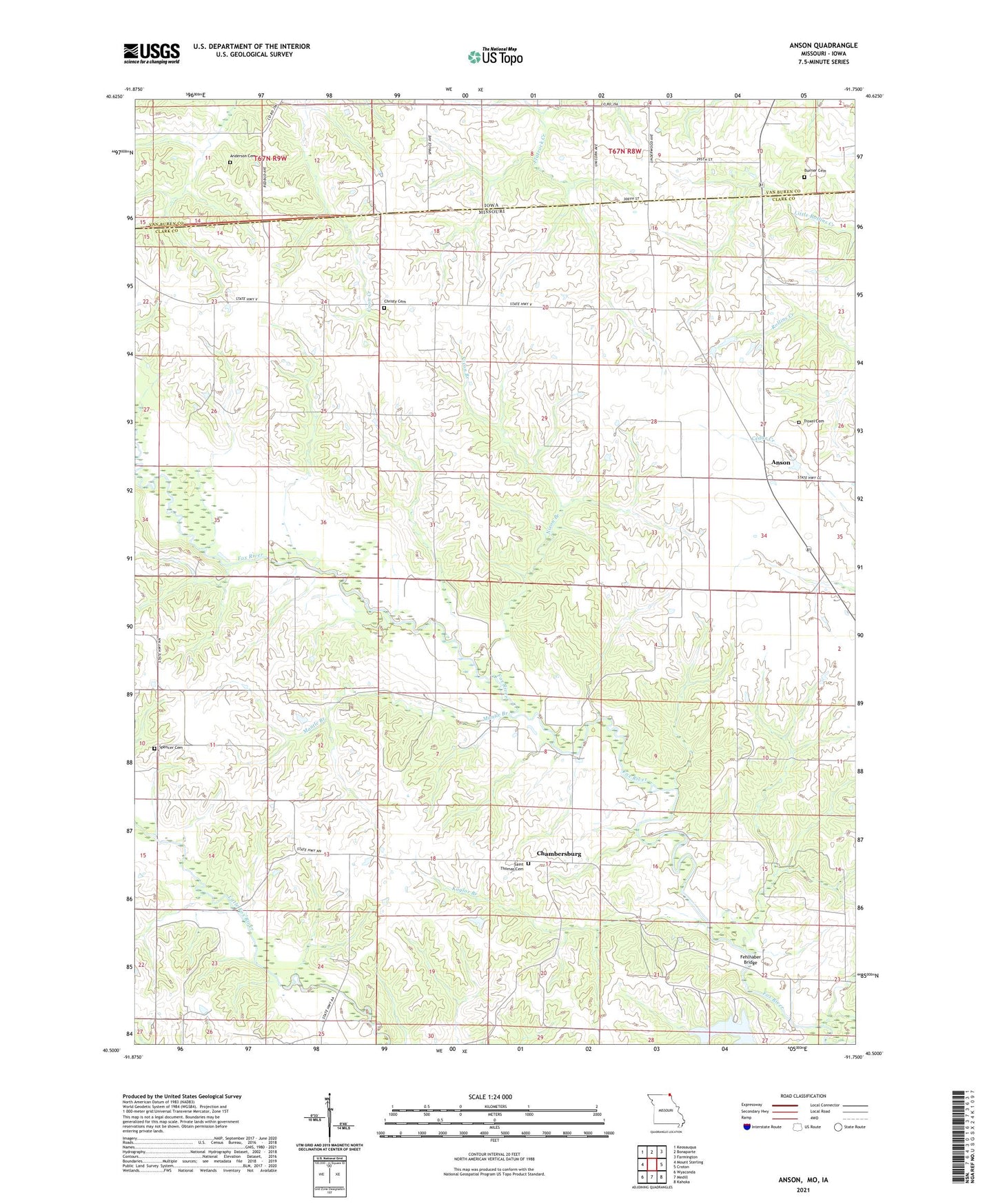
2021 topographic map quadrangle Anson in the states of Missouri, Iowa. Scale: 1:24000. Based on the newly updated USGS 7.5' US Topo map series, this map is in the following counties: Clark, Van Buren. The map contains contour data, water features, and other items you are used to seeing on USGS maps, but also has updated roads and other features. This is the next generation of topographic maps. Printed on high-quality waterproof paper with UV fade-resistant inks.
Quads adjacent to this one:
West: Mount Sterling
Northwest: Keosauqua
North: Bonaparte
Northeast: Farmington
East: Croton
Southeast: Kahoka
South: Medill
Southwest: Wyaconda
This map covers the same area as the classic USGS quad with code o40091e7.
Contains the following named places: Acasto, Acasto Post Office, Anderson Cemetery, Anson, Bethlehem Church, Burnt Shirt Branch, Burrier Cemetery, Chambersburg, Chambersburg Church, Christy Cemetery, Collins School, Community Church, Duncan School, Fairview School, Fehlhaber Bridge, Herring Lake Dam, Hogan School, Jordan School, Kaylor Branch, Mantle Branch, Nixon Branch, Saint Thomas Cemetery, Spencer Cemetery, Township of Grant, Township of Jefferson, Troxel Cemetery, Union Chapel, Upp School, ZIP Code: 63453