MyTopo
New Sharon Iowa US Topo Map
Couldn't load pickup availability
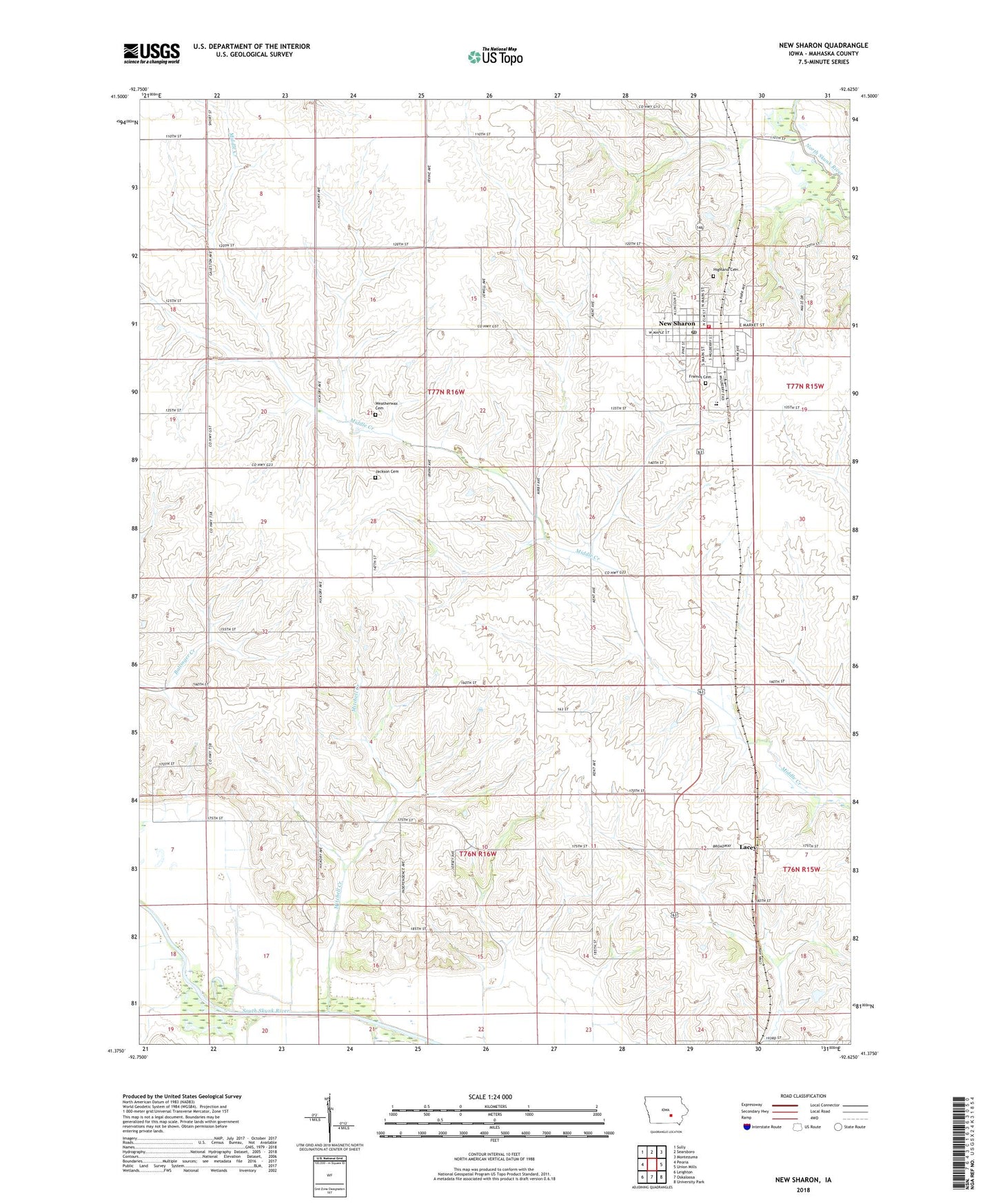
2022 topographic map quadrangle New Sharon in the state of Iowa. Scale: 1:24000. Based on the newly updated USGS 7.5' US Topo map series, this map is in the following counties: Mahaska. The map contains contour data, water features, and other items you are used to seeing on USGS maps, but also has updated roads and other features. This is the next generation of topographic maps. Printed on high-quality waterproof paper with UV fade-resistant inks.
Quads adjacent to this one:
West: Peoria
Northwest: Sully
North: Searsboro
Northeast: Montezuma
East: Union Mills
Southeast: University Park
South: Oskaloosa
Southwest: Leighton
This map covers the same area as the classic USGS quad with code o41092d6.
Contains the following named places: Assembly of God Church, City of New Sharon, First Christian Church, First Presbyterian Church, Friends Church, Highland Cemetery, Jackson Cemetery, Lacey, Lacey Post Office, Lacey United Methodist Church, Mitchell Creek, New Sharon, New Sharon Care Center, New Sharon Fire and Rescue Department, New Sharon Friends Cemetery, New Sharon Library, New Sharon Memorial Clinic, New Sharon Post Office, North Mahaska Elementary School, North Mahaska Secondary School, Prairie Knolls Country Club, Township of Madison, Township of Prairie, United Methodist Church, Vander Waal Airport, Weatherwax Cemetery, ZIP Code: 50207