MyTopo
Sully Iowa US Topo Map
Couldn't load pickup availability
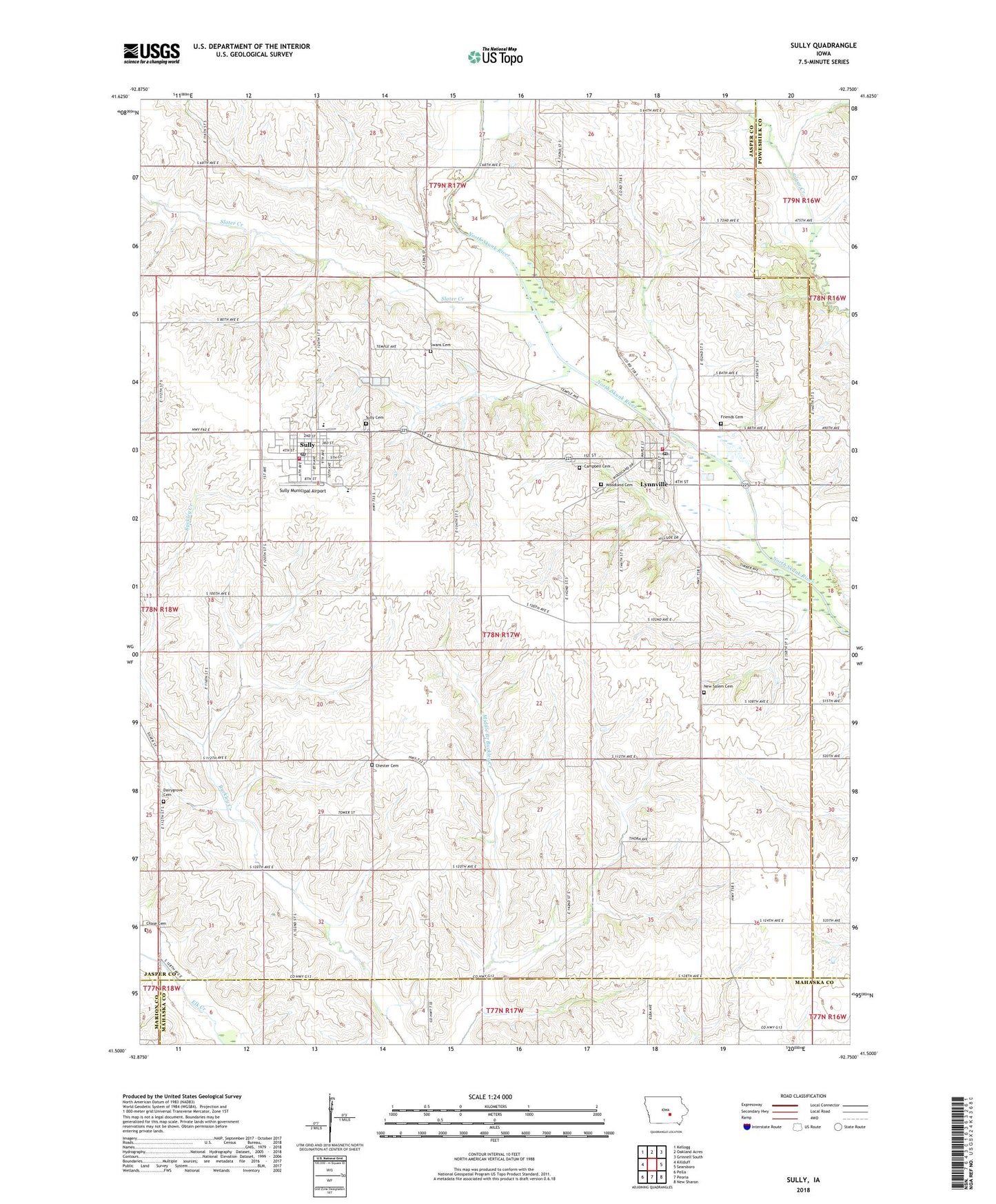
2022 topographic map quadrangle Sully in the state of Iowa. Scale: 1:24000. Based on the newly updated USGS 7.5' US Topo map series, this map is in the following counties: Jasper, Mahaska, Poweshiek, Marion. The map contains contour data, water features, and other items you are used to seeing on USGS maps, but also has updated roads and other features. This is the next generation of topographic maps. Printed on high-quality waterproof paper with UV fade-resistant inks.
Quads adjacent to this one:
West: Killduff
Northwest: Kellogg
North: Oakland Acres
Northeast: Grinnell South
East: Searsboro
Southeast: New Sharon
South: Peoria
Southwest: Pella
This map covers the same area as the classic USGS quad with code o41092e7.
Contains the following named places: Campbell Cemetery, Chase Cemetery, Chester Cemetery, Christian Reformed Church, Church of God, City of Lynnville, City of Sully, Dairy Grove Cemetery, Diamond Trail Golf Club, First Reformed Church, Friends Cemetery, Friends Church, Lutheran Church, Lynnville, Lynnville - Sully Elementary School, Lynnville - Sully High School, Lynnville - Sully Middle School, Lynnville City Hall, Lynnville Fire Department, Lynnville Library, Lynnville Medical Clinic, Lynnville Post Office, New Salem Cemetery, Slater Creek, Sugar Creek, Sugar Creek Post Office, Sully, Sully Cemetery, Sully Christian School, Sully City Hall, Sully Community Church, Sully Family Health Center, Sully Library, Sully Meeting Room Church, Sully Municipal Airport, Sully Post Office, Sully Rural Fire Department and Ambulance, Swan Cemetery, Township of Lynn Grove, Wagaman Mill, Wagaman Mill Museum, Woodland Cemetery, ZIP Codes: 50153, 50251