MyTopo
Leighton Iowa US Topo Map
Couldn't load pickup availability
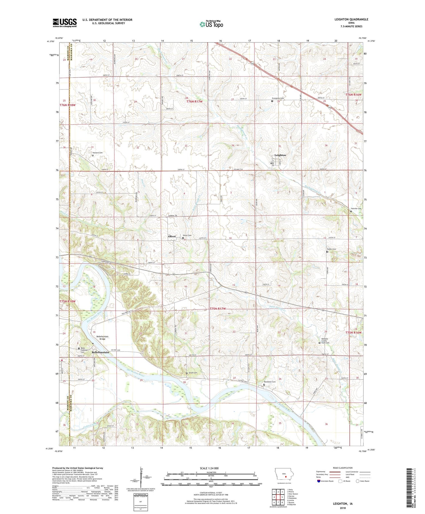
2022 topographic map quadrangle Leighton in the state of Iowa. Scale: 1:24000. Based on the newly updated USGS 7.5' US Topo map series, this map is in the following counties: Mahaska, Marion. The map contains contour data, water features, and other items you are used to seeing on USGS maps, but also has updated roads and other features. This is the next generation of topographic maps. Printed on high-quality waterproof paper with UV fade-resistant inks.
Quads adjacent to this one:
West: Harvey
Northwest: Pella
North: Peoria
Northeast: New Sharon
East: Oskaloosa
Southeast: Eddyville
South: Buxton
Southwest: Lovilia
This map covers the same area as the classic USGS quad with code o41092c7.
Contains the following named places: Auburn, Auburn Post Office, Belle Fountain Post Office, Bellefountain, Bellefountain Bridge, Bellefountaine Cemetery, Butler Cemetery, Cedar Bluffs Natural Area, Cedar Creek, Cedar Creek Access, City of Leighton, Clay Township Fire and Rescue, Ebenezer Reformed Church, Evergreen Cemetery, Fishville Cemetery, Howard Cemetery, Hull State Game Management Area, Leighton, Leighton Christian Reformed Church, Leighton Elementary School, Leighton Post Office, Mahaska County Farm, Mahaska County Farm Cemetery, Olivet, Olivet Cemetery, Olivet Post Office, Rochester Cemetery, Smith Cemetery, Township of Scott, Walnut Creek, ZIP Code: 50143